
Filed under: Codes & Regulations, Volume 003 | Tags: Architectural Code, Design Guidelines, Historic Districts, Ian Rasmussen, Landmark Commissions, Law, Preservation, Regulations, Zoning

By Ian Rasmussen
“[I]t is essential for the city to have confidence in new buildings as well and to know how to do it correctly in relation to the old.” — Vincent Scully, Jr.
Being designated a “historic district” is perhaps the greatest honor that can be bestowed upon a neighborhood. More often than not, what is being recognized is not the significance of historic events having occurred there, but that the neighborhood has a defined style and sense of place which contribute to our culture. This got me to thinking: Will Seaside—dubbed the most astounding design achievement of its era—ever be a historic district?
One place to look for an answer is at great planned neighborhoods from the past. Interestingly some, such as Boston’s Back Bay or Brooklyn’s Park Slope are historic districts; others such as Queens’ Forest Hills Gardens, or Kansas City’s Country Club district are not. The difference between them is that the latter are subject to architectural regulations and therefore do not rely upon historic preservation laws to protect them. Similarly, Seaside and most other new urbanist communities are subject to architectural regulations which served to define, and now maintain, their style. To be sure, the advancement of such codes is one of the most remarkable achievements of the new urbanism.
The fact that places like Seaside, or Forest Hills Gardens, can maintain a consistent and excellent architectural style without the aid of landmarks commissions, public hearings, and what is a whole other layer of regulation and administration, is not without significance. There are a number of values promoted by new urbanism that are furthered by the use of architectural codes, as opposed to preservation laws: for example, making the approval process swift, and its outcome more predictable.
From this writing, I have concluded that the question of how a City instills confidence in new buildings comes down to two central promises. First, that what we build will be better than what it replaces. There are really only two good reasons to knock anything down: it’s about to fall down, or you are going to replace it with something better. Whether old-growth trees or a grand building, so long as the replacement is more valuable, it is progress. Historically this is how we built. No sooner did we break this promise than did NIMBY-ism rise up and force us to spend our evenings being cross-examined at community meetings.
Second, that the more complex and imposing our regulations, the more swift and certain their administration. Tell people they can build whatever they like so long as the Town Board approves, and the process is at once flexible and indefinite. But, tell someone how tall, how wide, what color, and what type of windows their building must have, and they should be able to reasonably assume that if they meet your list of demands, they will be allowed to proceed.
Replacing the laws and approval processes of historic districts with architectural codes offers to fulfill both those promises, and improve the system along the way. Before explaining why, and to fully understand why the status quo isn’t the best solution, it’s useful to examine the problems historic preservation laws were invented to solve.
Background
The half-century from 1920–1970 bore witness to a stunning degradation in the quality of American architecture. Though the profession’s work had arguably peaked at the turn of the twentieth century, it really declined during this period. The reasons for this fall from grace are many, too numerous and complex to fully discuss. But, at least a few help put the rise of historic preservation in context.
First, the era of modernism and the “International Style,” borne of European architects and theorists in the 1930’s, materialized and became fashionable in the wealthiest, most advanced nation in the world: post-WWII America. Second, the influx of high-skilled, cheap labor (almost constant from 1860–1910) that allowed complex buildings to be economical dried up as immigration policies changed leading into the Great Depression and WWII. Third, the advent of the automobile, and the massive government subsidization of our transition to a way of life that revolved around it, stacked the deck against buildings and developments that did not accommodate the car.
Finally, and most importantly in my opinion, was a cultural shift from focusing on the quality of buildings, to the quantity of buildings. The generation that experienced adolescence in the throes of the Great Depression, and early adulthood in the battles of WWII, inevitably had a different outlook on what mattered. They understood that everything could be taken from you in an instant. They saw that all the grandeur of Paris or London could be bombed out tomorrow. It’s only natural they rebuilt as quickly as possible, and without regard for the ornamentation of buildings.
It was the perfect storm for the destruction of America’s older buildings. By the end of the 1940’s they were out of style, too expensive to repair, didn’t have enough parking, and were generally uncared for. And so we started knocking them down—a lot of them.
All of the great destructive trends in American history had a straw that broke the camels back: water pollution had “Love Canal”; endangered species had the Bald Eagle. For Historic Preservation, that straw was Penn Station. You could hardly have picked a better poster child. Penn Station was one of, if not the single grandest buildings ever constructed in this country. But as the railroads were being abandoned and dismantled, their stations fell into disrepair. For the Pennsylvania Railroad, which was struggling to survive, Penn Station was little more than a drag on its balance sheet. At the same time, under the newly adopted zoning regulations in New York City the site could be developed with over a million square feet of office space. To be fair, from a purely financial perspective it would have been foolish not to knock it down and sell the development rights for a new building. And that’s exactly what was proposed.
But it wasn’t just the building that made it so surreal and troubling, it was the entire episode. There was almost no opposition to the station’s destruction in the first place— protesters ranked not in the hundreds, or thousands, but in the tens. And the new station and the glassy office tower above it (which remain to this day) were simply dreadful. In case you haven’t been to the new Penn Station, the main entrance’s stairs descend to a concourse with nine-foot ceilings. As one critic famously said: “One used to enter the city as a king, now one scurries in like a rat.”
Though it is regrettable that such a tragedy had to occur, Penn Station’s greatest legacy will likely be as a catalyst for the historic preservation movement. In the years that followed, the loss of the station came to be nothing short of an embarrassment for New York; which soon after, in 1965, created a Landmarks Preservation Commission and began designating landmarks throughout the city. Realizing they had committed many heinous acts against their built heritage, other cities and towns across the nation followed suit.
The early success of the Historic Preservation movement, politically, culturally, and in the courts where its legality was confirmed, fueled its rampant spread. Not only among towns and cities, but within them, as diverse applications of “preservation” were experimented with. Obviously the first to be preserved were the landmarks, both historical and architectural—which more often than not do not overlap. Historical landmarks including buildings like the log cabin where Lincoln was born, and architectural landmarks including buildings like Grand Central Station.
Next came the advent of the “historic district.” Here things became slightly more complicated. Historic districts are composed of several buildings (typically several blocks, or even a whole neighborhood), most of which by themselves are not historically or architecturally significant, but which together form a place that is either historically important, or architecturally distinctive. You can imagine that if you weren’t able to protect any of Georgetown or Greenwich Village unless the buildings were independently or architecturally historic, those districts would be at risk.
The result is that now, the number of buildings that are protected elements of historic districts far outnumber the individual architectural and historic landmarks. To be clear, this essay doesn’t take issue with the system of landmarking individual buildings, but with historic districting.
The Existing Process of Historic Preservation
Now that historic preservation laws are virtually universal in this country, most of the important individual landmarks designated, and many of the important historic districts protected, allow us to focus on how (and if) the system works in practice. My involvement in, and perspective of, this process is as an attorney presenting applications to the Landmarks Commission; I mediate a debate about what should be built between the preservationists, the architects, and developers.
So you’ve purchased a vacant property in a historic district, or an old building you want to renovate or enlarge. How does the historic district constrain you? Generally, the answer is that in addition to presenting plans that conform to your local building and zoning codes (to get your permits), you need a separate approval from the landmarks commission (called a “certificate of appropriateness”). The only catch is that where the building and zoning codes are fairly clear in what is required, the idea of “appropriateness” is very vague. To be sure, there isn’t even a place where what it means to be appropriate in the historic district is defined. The solution is to visit the district, try to discern its common characteristics, and design something that emulates that style. Good architects, who understand urbanism, can design a contextually appropriate building on the first try. However, most architects learned to design without context in school, and design according to the bottom line in practice; the idea of context and precedent is foreign to them.
Here is how the rest of the story plays out: you present your plans to the landmarks commission; they say it’s not appropriate for this reason or that (all subjective opinions, mind you); the architect revises the plans; you present again; whereas last time the commission didn’t like the windows, now it’s the awning, or the entrance. This cycle repeats itself a few more times until the commission feels like they’ve gotten something out of the developer. The whole affair takes, and costs, about four times more than designing a building anywhere else in the city.
I love old buildings, and I don’t care for modern architecture, so I think I am as much a supporter of preservation as anyone; but there is something horribly wrong with this process. Though I’ve oversimplified it, and maybe even demonized the landmarks people in the process, that’s pretty much a fair telling of the system from my point of view. And, what’s really ironic is that most of the developers I work with are so eager to get the project done, they are willing to do almost anything the commission tells them to. Forget the archetype of the heartless developer; most just want to be told in clear terms, so they can tell their bank, exactly what they need to do for guaranteed approval.
The Approval Process with an Architectural Code
Now consider the experience of a person who has purchased a vacant lot at Seaside. Like anyone else, they want to know what they can build. The answer is found in the community’s urban code (which is like a zoning code), and architectural code. The entire document is a double-sided 11″ x 17″ sheet. What is appropriate in Seaside? A design that complies with its codes. Period.
Seaside, of course, benefits greatly from having a town architect to work with the owner and project architect to develop a compliant design. But even that is much less expensive, not to mention less cumbersome, than having an entire landmarks commission. If a design that is presented to the town architect is fully compliant with Seaside’s codes, it will generally be approved. How long it takes to develop a compliant design is up to the architect and owner; not a product of the process.
Again, I’ve simplified the whole process for the sake of discussion. And, I should mention that the ultimate discretion over what gets built in such place still lies with the town architect, even if the design is fully compliant. For the most part, though, that’s it.
Replacing Historic Districts With Architectural Codes
Not only are architectural codes a better tool to regulate new construction, but also development in historic districts. The advantages, though more plain in the case of new construction, also apply to older buildings. Before delving into why architectural codes are a better way to regulate historic districts, it’s important to understand why this is true.
We need to stop thinking of old buildings in historic districts as “historic buildings.” Historic buildings are places that are important to history. Old buildings in historic districts are just a part of historic places. These places can, with a tight architectural code, survive without all their original parts.
Consider why preserving historic districts became so important in the first place: people were knocking down beautiful old buildings and replacing them with garbage. If what was being constructed in place of the old buildings were newer, better buildings—architecturally, structurally, functionally and technologically—would we have minded in the first place?
Will many people knock down a beautiful old building when the only thing they are allowed to put in its place is a comparably sized, similar looking, new building. In fact, a good architectural code favors renovating or enlarging older buildings over demolition and new construction.
With regard to vacant properties being developed, there is no reason to believe that a new building developed under an architectural code will be any worse than one developed under a landmarks commission. Given the inability of such commissions to effectively communicate to the architects and developers, the code may even provide for better results!
The Advantages of Architectural Codes
There are numerous reasons why architectural codes are a better way to handle development in historic districts than the approval process of historic preservation. Maybe you hate big government, and the idea of one more layer of bureaucracy keeps you up at night. Or maybe you’ve been through the interminable process and endured hours-long public meetings at which the angry neighbors actually get a say in what you can build on your property. Ideologies aside, there are four specific advantages to using architectural codes.
The first is efficiency. Whether or not you think government should play a smaller or larger role in our lives, and whether it should shrink or expand accordingly, it’s fair to say no one supports waste—and the approval process of preservation is full of it. Think back to the hypothetical in the preceding section. The architect had to spend four times as long producing his plans; four times the paper, four times the pens, and so on. The developer also had to spend four times as much money. Everyone had to attend several public hearings. The commission has to be there, the project team needs to be there, and even the concerned neighbors had to take the afternoon off to be there, on several occasions. This is a waste of everyone’s time and resources. Not just the developers, but the municipalities and the citizens as well.
If there were an architectural code in place, how many of the gaffs in the early design proposals, and how many of the back-and-forths over them would have been obviated? How much closer would the architect’s first try have been to the final design? And, equally important, would it have been as good as what came out of the landmarks commission process? With a well-written architectural code, the answer is as good or better.
The second is objectivity. The law should be applied objectively. After all, why does the law prescribe how much you have to steal before its “grand theft” or how much pollution you can put in the air before you need a certain permit. You would not want to live in a world where whether you went to jail for two years or five depended on whether a commission thought what you stole was “grand,” or where your permitting requirements were subject to what a commission thought of your pollution. In virtually every corner of regulation, the law strives to reject these subjective opinions in favor of objective requirements.
The laws of historic preservation are a notorious exception to this general rule, mostly because it’s tough to codify style. Of course, this is what makes the issue one for the new urbanists; the group that has not only reintroduced the idea of architectural coding, but made great strides in the field. The bottom line is that in the absence of knowing a better way to regulate, the laws of historic preservation rely almost entirely on the subjective opinions of a few people. By comparison, architectural codes are almost devoid of subjective opinions, and rely on objective requirements, agreed upon by everyone at the outset, to get the job done.
A related advantage is the third: a dependable outcome. Not only with preservation, but with the public process, which dominates the field of planning, we completely got it wrong. Anyone who has ever applied to build anything—whether it’s a 10,000-unit new town or a backyard swimming pool—wants to know is what they are allowed to do. And what they are really getting at is not only what is permitted, but that if they comply with those requirements, it will be promptly approved. What’s been getting built since 1945 is basically so horrible that in most cases, and certainly any that are larger than a few buildings, we have decided there is no set of requirements that guarantee approval; we want to be able to veto anything. Historic districts are the epitome of this idea.
The problem is that this way of doing things runs contrary to one of the basic tenets of regulations: that the more complex and imposing the regulations, the more dependable their outcome should be. In other words, if you’re going to tell me exactly what I can build not only in terms of height and form, as with zoning, but also in terms of materials, colors, and details right down to the shape of the windows and their ornamentation; then I should be able to expect that you will make those requirements clearly known to me, and if I meet them, then I can proceed. That is basically what an architectural code does; it clearly defines compliance.
The approval process of preservation has the equation backwards; they not only want an intrusive degree of power, but they aren’t going to nail down a set of criteria to review against. Imagine, a legal process—and that’s what preservation is—where those in charge control almost every aspect of a building, but don’t have to you their requirements. In those terms it almost sounds despotic. A good deal of the resistance to historic preservation arises out of precisely this frustration.
Finally, and this may be the most important thing architectural codes have to offer, you to not need to be an old neighborhood to deserve and take advantage of their benefits. Doesn’t it strike you as at least somewhat unfair that older neighborhoods have this entire field of law, and world of administrative processes, organized with the goal of protecting their best buildings (and the value of the surrounding real estate) while anything newer, no matter the quality, is left out to dry? Is it any wonder the overwhelming majority of new homes constructed in the past ten years have been located in gated communities with home owner’s associations and deed restrictions?
Americans are probably the last to admit that they would sacrifice the freedom to put plastic flamingoes in their front yard, but more than any other nation in the world we are building and electing to live in places where private governments control everything from lawn furniture to new siding. This trend is nothing less than a cry for architectural regulation, and it’s no coincidence it arose just as suburban sprawl and modern architecture began to consume the landscape. Where the environmentalists have spent all their energy making sure nothing happens to nature, while completely ignoring what gets built, so have the preservationists spent their time obsessing over existing places, and completely ignoring new ones. Both of these positions espouse a hopelessness that leads nowhere.
The truth is that most Americans who live in places that are at all dense—meaning they can see the next house—want some level of guarantee that their neighbor isn’t going to build a neon-colored curiosity that hurts their property values. It’s not unlike the circumstances surrounding the advent of zoning. Though most of the talk surrounding the famous Euclid decision is about the segregation of uses it condoned, the most telling words of the decisions speak of the apartment house in the single family neighborhood as a “pig in the parlor,” which are as applicable to an ugly building as they are to a functionally different one.
The response on the part of preservationists has been to over landmark. What happens is that well-formed neighborhood groups lobby to get their neighborhood designated a historic district. Whether or not it’s the most deserving of places, and whether or not more historic places have yet to be protected, the landmarks commission responds to political pressure. The result is the creation of historic districts all over the city, which have as much to do with out of control new development as they do history. Meanwhile, newer areas that are clearly not ripe for preservation call on the city to downzone their areas to a density much lower than actually exists. The goal being to create an environment where, because of the abnormally low zoning potential, no one will knock an existing building, or build a new one either.
Conclusion
All any of us want, in old neighborhoods or new ones, whether you care about urbanism or not, is a reasonable expectation that what is going to be built will be as good as what it replaces, and some idea what that’s going to look like. Is that so much to ask? These simple objectives are more easily achieved with a code than with a commission; and in the process, we’d be making our approval process more swift, fair, and definite as well.
– – –
Ian Rasmussen is an attorney and urbanist living in New York City. His practice focuses on land use, zoning, and urban design.
[image by Rego-Forest Preservation Council]
Filed under: Music, Volume 003 | Tags: Arcade Fire, Music, Music Review, Sprawl, The Suburbs, Zack Adelson

The ill effects of sprawling settlements development patterns are well documented. Numerous books, articles, and films have discussed the negative physical, economic and ecological impacts associated with suburban sprawl. However, as a medium for expression, the music industry provides few examples of sufficient coverage. Countering this trend is the band Arcade Fire, whose latest album, The Suburbs, brings to life their own experiences growing up in such an environment. In doing so, they paint an eerie, but accessible picture of what many kids go through growing up in America.
The Arcade Fire is an indie rock band formed in Montreal, Canada by husband and wife duo Win Butler and Régine Chassagne. The group also includes Win’s younger brother, William Butler. Win and Will were born in Northern California, near the Nevada border, in a small rural town. When the brothers were young their family moved to the Woodlands, Texas, a well-known master planned suburb on the outskirts of Houston. The change in scenery was so drastic that Win says “it was like landing on Mars.” What was then an unfamiliar new place sets the stages for the hazy memories that comprise The Suburbs.
The central themes of boredom, confinement, loneliness and regret are brought up repeatedly throughout the album. Some of the most powerful imagery in many of the songs is accompanied by the idea of being lost—Win uses this as a metaphor for feeling afloat in life, with no particular direction. But this sense of confusion is also directly related to the disconnected life he once lived in the suburbs. The point is driven home on the album’s most somber song, Sprawl I (Flatland).
The track describes Win’s return visit to the Woodlands neighborhood where he spent the majority of his childhood. But with so little connection to the place he once lived, he is unable to find the right house. More telling is that during the entire song he deliberately avoids the word “home”. Instead, he searches for “the house where we used to stay.” Towards the end of the track Win recalls being asked by a police officer where he lives. He replies that he does not know but has been searching every corner of the Earth.

Beyond being lost in the sprawl, the Butler brothers also seemed to grow up bored. Many of the songs ring with a tone of regret, recalling summer days wasted indoors, germinating half-baked ideas that were never realized. The listener understands that the brothers did not lack creativity, but simply had no outlet for their talents.
Listening deeper into the album, several songs reference a “suburban war,” a metaphor for childhood fantasies enacted through play. From personal experiences, it could have been a neighborhood wide game of flashlight tag or building a skateboard ramp in the backyard.
“But by the time the first bombs fell
we were already bored
We were already, already bored.”
For the boys the excitement comes in merely talking about their ideas. However, when it came time to see them through to fruition, the motivation runs dry. The disappointment that goes along with discarded plans reveals a sense of impotence, a feeling that makes the suburbs an even lonelier, alienating place.
Among all of the intangible ideas about suburban life discussed on the album, the Arcade Fire offer several hints as to why the Woodlands was such a depressing place to live. In the high-energy track, Month of May, they make a direct reference to automobile-centric planning.
“First they build the road, then they built the town
That’s why we’re still driving around
And around and around and around and around and around and around and around and around”
Similar explanations are heard during the opening presentation of any New Urbanist design charrette.
Towards the end of the album, Chassagne sings about a seemingly post-apocalyptic landscape in the song Sprawl II (Mountains Beyond Mountains). The tune’s subject matter could be lifted straight from the writings of James Howard Kunstler.
“Sometimes I wonder if the World’s so small
That we can never get away from the sprawl
Living in the sprawl
Dead shopping malls rise like mountains beyond mountains
And there’s no end in sight
I need the darkness, someone please cut the lights “
Clearly, The Arcade Fire portray sprawl in a negative light. However, after listening to The Suburbs the question remains: if not low-density, auto-oriented neighborhoods, for what do they advocate?
Surprisingly, the album reveals a mix of feelings towards cities. Indeed, several tracks portray cities as confusing places where people easily lose themselves, while others praise cities as the places where exciting and interesting people live. Ostensibly, the band has grown comfortable with urban living, as they reside in Montreal, one of North America’s most cosmopolitan cities. However, the album reveals that the brothers Butler still long for the soothing calm of their rural birthplace.
When confronted with the question in interviews, Win replies that his goal for the album was to talk about real experiences rather than pretend he grew up in a more edgy, urban environment. The accessibility of the writing is exactly what makes the album so powerful because current and former suburban inhabitants may easily place themselves within each song, making them all the more real and haunting.
– – –
Zack Adelson is a designer and urban advocate currently living and working in Portland, Maine.
Filed under: Economic Development, Urban Planning, Volume 003 | Tags: Bethany Rubin Henderson, Brain Drain, Economic Development, Economy, Human Capital, Jobs, Planners, Public Sector, Ted Wieber III

by Bethany Rubin Henderson and Ted Wieber III
Urban Planning is a public sector occupation. According to the US Bureau of Labor Statistics, nearly 80% of urban planners in the United States work for governments, more than 66% work in local government.1 This fact may not be surprising given the often community-wide impact of planning work, but it means that the health and vitality of the planning profession depends largely on the health of local governments. And right now, America’s local governments are facing a severe talent crisis. While urban planners are comparatively well-off – increasing urbanization in the U.S. will lead to an expected 19% increase in the demand for urban planners between now and 2018 – most other local government sectors are facing a mass exodus of their most experienced workers without a sufficiently large pool of talented replacements to draw from. The fiscal and operational challenges facing cities are more difficult than ever before; yet the brightest minds are in short supply. As this crisis threatens to destabilize local governments across the country, it is more important than ever to aggressively recruit the most talented people to solve our municipal challenges.
The Relationship between Urban Planning and the Public Sector
Many of the most innovative urban planning ideas begin as broad visions devoid of regulatory context: “Wouldn’t it be nice if people could walk more in this part of town?” or “How might we create more vibrant public spaces?” or “How might this community achieve higher usage rates of public transportation?” These are questions that New Urbanists have continuously sought to answer. However, urban planning does not move forward in a regulatory vacuum. The challenge of planning lies in transforming these visions into realities. This metamorphosis can only be achieved through an intimate, and often lengthy, give-and-take with local governments and the people that run them. Like a caterpillar entering its cocoon before being reborn as a butterfly, so a planning vision must weather the halls of city government before emerging as a reality.
Who, exactly, are the people who influence planning at the local level? They include planning department employees, planning and zoning commissioners, building code inspectors, infrastructure engineers, environmental impact analysts, transportation analysts and many others depending on the needs of a particular city, community or project. Beyond the staff directly involved in evaluating proposed development projects, mayors, city managers, council members, and other city officials affect the process by determining local economic policy, property tax rates, and the amounts of impact fees, permit fees, and other fees or taxes that development projects must shoulder. Both elected and appointed city leaders, across agencies, also produce comprehensive community plans, decide the priorities of capital improvement programs, and determine official zoning and subdivision rules.2 Considering the intricate web of regulatory steps that any proposed development must survive, turning a planning vision into a reality can be a herculean task. And that does not even include the outside challenges developers and planners face, like financing a major project.
Moreover, regional, state and federal governments impose constraints on the planning process that can limit the ability of cities to pursue planning initiatives. For example, states and regions often produce transportation plans governing the development of road networks across a region and infrastructure plans with standards for water resources, wastewater treatment, air quality, parks, and transit. State governments and the federal government also control important purse strings. For example, the 2009 American Recovery and Reinvestment Act made enormous sums of money available to state and local governments for “shovel-ready” projects. Local officials have to compete for such money, often by meeting detailed Federal criteria and marshaling local political forces. Without competent, proactive and forward-thinking municipal employees, deserving communities can miss out on important financing that can make or break a needed planning initiative.
The point to take away from this laundry list of governmental actors and regulation is that the influence of government workers on the planning process is enormous. And a malfunctioning local public sector can make the job of urban planners extremely difficult – and significantly more expensive – to accomplish. The tangled web of overlapping plans and regulations can only be navigated – and reformed – by a vibrant and talented supply of knowledgeable local government workers across all fields.
The Aging Workforce
Unfortunately, America’s city governments face a talent crisis. Although the planning sector is expanding, the majority of local government administrators – not the politicians, but the people who do the day-to-day work that keeps cities running and public services on track – either could retire today or will become eligible for retirement within the next five years.34 This looming personnel exodus threatens the ability of cities to function.
The aging government workforce is not simply a consequence of the baby boom generation approaching retirement. While only 48% of private sector employees are over 40, a whopping 63.5% of local government employees are.5 Local government employees are, on average, 5-7 years older than their private sector counterparts.6 Furthermore, local government is disproportionately a “knowledge industry” requiring workers with specialized education, training or skill sets. Two-thirds of local government employees are knowledge workers; only one-third of private sector workers are.7 Nearly half of public sector employees have college degrees, versus fewer than one-quarter of private sector employees.89 Age and education levels almost twice those of the private sector illustrate that the personnel challenges facing government workforces are more serious than those of other job sectors. Interestingly, an aging government workforce is not solely an American challenge. Thirteen member countries of the Organisation for Economic Co-operation and Development (OECD) have public sectors where workers 50 or older comprise 30% or more of the total workforce.10
If left unchecked, the consequences of an aging municipal workforce could be devastating. First, in a few short years there simply will not be enough people to do the job. Even accounting for the inevitable downsizing and shrinking head-counts that will be lasting effects of the recession, the out-migration of experienced baby boomers will leave numerous vacancies – far too many to be filled by the existing pipeline of talent entering local government. Without adequate staff, cities will not be able to function, much less be efficient and effective stewards of public resources. While an occasional shake-up of the status quo has benefits, the current disruptive human capital crisis threatens consequences that only the skills and innovative thinking of America’s brightest talent can overcome.
Second, an outflow of experienced personnel may lead to the permanent loss of institutional knowledge. The lessons learned and experience acquired after decades of public service are extremely valuable, as relationships and job-specific expertise can only be built over time. Loss of that institutional memory will significantly weaken the knowledge base of municipal agencies. Now that so many government employees are nearing retirement, the threat of a devastating “brain drain” is becoming an imminent reality.
Third, the aging workforce threatens to topple government finances. Municipal budgets across the country are under enormous pressure. The decline in tax revenues due to the recession can be blamed for some of the trouble. However, the long-term strain on municipal budgets comes from pension and benefit obligations promised years ago. Americans are now living longer than ever. Government workers who retired over the past few decades, and those who will retire in the next few, will draw on their pensions and health benefits for much longer than cities budgeted for.11 Besides consuming increasingly large shares of municipal budgets, these pension obligations limit governments’ flexibility to address all of their other responsibilities. To meet their obligations, local governments will have to continue to cut services, shrink programs, and defer or abandon new initiatives. Furthermore, strained budgets could result in cost-shifting from the public to the private sector, driving up the costs of a project for private sector planners and developers.12 Planners – who must inevitably work closely with local governments whether they are employed by them or not – will find cities more financially strapped and inflexible than ever before.
Where are all the young people?
But perhaps the most alarming aspect of the talent crisis is the absence of young college-educated workers in the municipal pipeline. Americans need the same caliber of people in local government who traditionally join top-tier law firms, consulting firms, investment banks, Teach for America and other high-profile or high-profit careers. For decades, America’s best and brightest college graduates have spurned local government service, leaving talented younger workers in short supply. Moreover, recession-driven layoffs – which, in the public sector often favor seniority over performance – are exacerbating the problem by forcing out many of the youngest workers that currently are in the pipeline.13
There are many reasons why young college graduates avoid municipal jobs. First, most college students know little about what government workers actually do, and the little they do know worries them. Many equate working in government with either being a politician or being stuck in an inflexible bureaucracy and endless red-tape.1415 Today’s younger workers want to work in meritocracies that value innovation and creativity and provide opportunities for continuous learning. They crave positions that challenge them, where they can be partners in the enterprise from day one, and that provide a good work-life balance.1617 Few think of municipal agencies as providers of this environment.
Second, a pervasive, decades-old anti-government bias turns off many young Americans from considering government work, even those inclined towards public service.18 Indeed, the 2009 National Leadership Index from Harvard’s Kennedy School of Government found that Americans have a below-average level of confidence in local government.19 Further, when asked to estimate the inefficiency of local government, Americans believed that local governments waste more than 36 cents of every tax dollar they collect.20 Young people also connect “public service” with working for non-profits – not working in government.21
Third, young people simply are not being asked to join government.22 Worse, many city governments’ civil service rules make it nearly impossible for people right out of college to join their workforce by requiring several years of experience for entry-level jobs. Compounding the problem, college graduates now can, and frequently do, move around freely to chase opportunity. Being less rooted in their local communities discourages them from investing time and effort in tackling local challenges.
Finally, public sector compensation packages do not meet the needs of younger workers.23 Local governments pay knowledge workers 25% less than the private sector, and the public-private sector pay gap has grown in the past 15 years.2425 This makes it even harder for cities to recruit and retain the highly-skilled professionals who comprise so much of their workforce – including many who impact the planning process, like engineers and environmental scientists.26
Despite these challenges, engaging recent college graduates in local government is not impossible. Doing so simply requires re-imagining how we inspire and empower them to solve local problems. In fact, public attitudes are shifting, and today we have a unique chance to re-focus our top young people back to the local level. Many 18-30 year-olds now report that doing good for society is as important to them as doing well financially. As importantly, the reflexive anti-government sentiment among young people is decreasing for the first time in decades.2728 A January 2010 Gallup poll found that, while 59% of Americans age 18-30 still prefer working for a business over working for the government, 37% now favor government jobs. Further, 42% of college students now agree that getting involved in politics is honorable.29
What does all of this mean for Urban Planners?
A combination of trends is launching urban planners to the forefront of civil society. First, America is growing rapidly. Demographers forecast the national population will grow to more than 400 million by 2050.30 Second, America is increasingly urbanizing. The Brookings Institution predicts that nearly 90% of Americans will live in metropolitan areas – cities of 50,000+ and their economically-dependent adjacent counties – by 2030.31
Third, there is a renewed emphasis in America on finding local solutions to social problems. Cities are now being placed front and center in the public conscience. How creative urban planning can improve the quality of daily life, public health, and the environment are goals receiving significant attention. Even mainstream media is rife with praise for the social benefits of experimental urban renewal initiatives like New York City’s conversion of Times Square traffic routes to pedestrian thoroughfares, or Stockholm’s bid to make physical activity fun with its “piano stairs.”
In a nutshell, our growing and increasingly urbanized population will place greater stress on municipal services and infrastructure—creating a stronger demand for the expertise of urban planning professionals. It should be no surprise, then, that the U.S. Bureau of Labor Statistics predicts that the number of urban planning jobs will increase by a startling 19% between 2008 and 2018, a faster-than-average occupational growth rate.32
This growth might be welcome news to professional planners, but it poses a serious challenge to local governments. Not only do cities lack bench strength among their non-planning staff, most also lack viable long-term succession and recruitment plans.3334 Combine an increased demand for city services, a mass exodus of experienced workers and a lack of incoming talent, with no plan for how to deal with this challenge, and you have a perfect storm. Urban planners are caught right in the middle. Weakened local governments translate into a weakened support-system for urban planning initiatives.

One Solution to Attract the Best
Our national, non-partisan nonprofit, City Hall Fellows, offers one solution to the personnel challenges facing local governments. City Hall Fellows has found an effective, cost-efficient and highly-impactful way to convert college students’ renewed interest in public service into their taking responsibility for the challenges in their hometowns. Partnering with city governments, City Hall Fellows runs a Teach-for-America-style national service corps program that includes more than 300 hours of training on local government policy – how decisions are made, how local policy is designed and implemented, and how programs are evaluated. The year-long, cohort-based Fellowship integrates this intensive training with hands-on, full-time professional experience working on substantive projects for city agencies.
City Hall Fellows puts America’s best and brightest recent college graduates to work directly on many of the challenges cities face – including many of the challenges affecting urban planners. For example, a recent Fellow served in the Houston Planning and Development Department. His mission for the year: tackling the problem of institutional memory loss in his department. As the largest city in the United States without zoning, Houston has a very unique approach to regulating planning. In the absence of a zoning ordinance Houston utilizes a variety of stand-alone nuisance ordinances that curb the most egregious land-use incompatibilities while preserving the enormous development flexibility that comes from limited regulation. His work was a key component of a forward-looking department initiative led by senior management to arm current and future planners with knowledge of the department’s past. A comprehensive historical review of Houston’s development ordinances – why the city passed them, how they have been amended over time, and the kinks that may still exist in their implementation – will allow the department to preserve and learn from its history and from the experience of its most senior employees, even as they retire.
But City Hall Fellows alone cannot prevent the potentially devastating blow to our cities – or to occupations like urban planning that depend on cities’ efficacy – from the enormous municipal talent crisis.
What else can be done?
Most importantly, governments must recognize and prioritize their personnel challenges and place greater emphasis on recruiting and retaining new talent. First, cities must overhaul hiring and recruitment practices by removing unnecessary barriers to entry for promising talent. For example, the City of Houston currently requires three years full-time experience for many entry-level positions. This rule effectively precludes top graduates from Houston’s six major universities from working for the city right after college.
Second, the public sector needs to market itself more effectively to college students. While strained municipal budgets may preclude offering pay packages on par with the private sector, public sector workers still enjoy benefits that can more than compensate for the cash discrepancy. For example, young public sector employees get to work at the cutting edge of public policy – and have a real impact on their communities. Likewise, in many cities, public sector workers enjoy more flexible working hours and more paid vacation days than their private sector counterparts.35 As noted above, recent polls show that this combination of intellectually stimulating work that directly impacts the public good combined with generous non-cash benefits is very appealing to today’s college students. Yet, few college students know that local government employment offers these opportunities. Cities can go a long way towards solving their brain drain problem simply by raising college students’ awareness of what working for cities is really like. Social media platforms allow cities to cost-effectively reach tens of thousands of prospective new college-age workers.
Third, senior city workers should actively ensure that their knowledge and experience is not lost. Before retiring, they should document the most vital institutional memory. They should also mentor younger employees in their agencies, preparing them for leadership. Finally, public sector urban planners, ordinary citizens and private sector workers must realize that the municipal talent crisis directly impacts their livelihoods: professionally, financially, and in the quality of service that their government can provide. While private corporations are responsible to their owners and stakeholders, the public sector can only be held accountable by an informed and engaged citizenry. All of us have a responsibility for ensuring our cities continue not just to function, but also to effectively and efficiently serve our needs. An awareness of the talent crisis local governments face must be translated into momentum for the innovation and restructuring required to ensure a healthy future for America’s cities.
Conclusion
Left unchecked, cities’ human capital crisis could undermine even the best-laid urban plans. Talented and innovative people are the key to solving governments’ most intractable problems.
Awareness of the brain drain plaguing the public sector – and consequently the urban planning profession – is slowly growing. But, for change to happen, the chorus needs many more voices clamoring for reform. Urban planners in particular, as an occupational group overwhelmingly concentrated in the public sector, must be on the front lines of this campaign. Planners must demand that their municipal governments prioritize the talent crisis and address it as swiftly as possible; and they must be willing to partner with local governments and non-profits like City Hall Fellows to incentivize talented younger workers to enter public service. Without a steady pipeline of talented workers who can think more creatively than ever before about municipal government’s challenges and how to solve them, the future of America’s cities looks bleak.
SOURCES
Armah IV, Niiobli, et al. “Making Public Service Accessble: Opportunities to Improve the Hiring Process for Our Next Generation of Municipal Employees.” A Report by the Houston City Hall Fellows, July 22, 2009.
Barrett, Katherine & Richard Green. “An Unproductive Bump.” Governing, April 1, 2010 http://www.governing.com/columns/smart-mgmt/An-Unproductive-Bump.html
Bender, Keith A. & John S. Heywood. “Out of Balance? Comparing Public and Private Sector Compensation over 20 Years.” Report commissioned by the Center for State & Local Government Excellence and the National Institute on Retirement Security. April 2010
Benest, Frank, Ed. “Preparing the Next Generation. A Guide for Current and Future Local Government Managers.” International City/County Management Association, 2003.
Benest, Frank. “Retaining and Growing Talent: Strategies to Create Organizational ‘Stickiness’.” ICMA’s PM Magazine. Vol. 90, No 9, October 2008. http://www.frankbenest.com/ICMA%20article.pdf
Bilmes, Linda and W. Scott Gould. The People Factor: Strengthening America by Investing in Public Service. Washington, D.C.: Brookings Institution Press, 2009
Council for Excellence in Government. “Calling Young People to Government Service: From ‘Ask Not…’ To ‘Not Asked’.” a Peter D. Hart Research Study for the Council for Excellence in Government, March 2004.
Council for Excellence in Government & the Gallup Organization. “Within Reach . . . But Out of Synch: The Possibilities and Challenges of Shaping Tomorrow’s Government Workforce.” updated May 22, 2007. Retrieved May 20, 2010 from http://www.hreonline.com/pdfs/06162007Extra_GovernmentStudy.pdf
Dohrmann, Thomas, et al. “Attracting the Best.” McKinsey and Co Transforming Government. Autumn.2008. http://www.mckinsey.com/clientservice/publicsector/pdf/TG_attracting_best.pdf
Economist. “A tough search for talent.” 31 Oct 2009.
Franzel, Joshua M. “Future Compensation of the State and Local Workforce.” http://www.thepublicmanager.org. http://www.slge.org/vertical/Sites/{A260E1DF-5AEE-459D-84C4-876EFE1E4032}/uploads/{2861CCEA-7045-4C8D-86F0-1C5323204D17}.PDF
Gallup Government Poll, 2009. http://www.gallup.com/poll/27286/Government.aspx
Greenfield, Stuart. “Public Sector Employment: The Current Situation.” Center for State & Local Government Excellence, 2007, http://www.slge.org/vertical/Sites/{A260E1DF-5AEE-459D-84C4-876EFE1E4032}/uploads/{B4579F88-660D-49DD-8D52-F6928BD43C46}.PDF
Henderson, Bethany Rubin. “Don’t Shut the Door on Your Way Out: Stopping the Threat to City Operations Posed by the Aging Municipal Workforce.” 97 National Civic Review 3, p. 3 (Fall 2008)
Kellar, Elizabeth, et al. “Trends to Watch in 2010.” PM Magazine (ICMA Press) Vol. 92, No 1, January/February 2010 (cover story) http://icma.org/pm/9201/public/cover.cfm?author=Elizabeth%20Kellar,%20Joshua%20Franzel,%20Danielle%20Miller%20Wagner,%20and%20Joan%20McCallen&title=Trends%20to%20Watch%20in%202010
Kotkin, Joel. The Next Hundred Million: America in 2050. Penguin Press, 2010.
Levine, Peter, et al. “The Millennial Pendulum: A New Generation of Voters and the Prospects for a Political Realignment.” New America Foundation Next Social Contract Initiative (Feb. 2008). http://www.womenscolleges.org/files/pdfs/Millennial_Pendulum_Feb08.pdf
Miles, Mike E., et al. Real Estate Development: Principles and Process. 4th Edition. Urban Land Institute, 2007.
“National Leadership Index 2009.” Center for Public Leadership, John F. Kennedy School of Government, Harvard University.
Partnership for Public Service. “Poll Watch: Public Opinion on Public Service.” May 2, 2005.
Pew Research Center. “Millenials: A Portrait of Generation Next.” 2010. http://pewsocialtrends.org/assets/pdf/millennials-confident-connected-open-to-change.pdf
Puentes, Robert. “How Are We Growing? Where Are We Going?: How We Will Live and Move in 2050.” Presentation at American Transportation Association. Sept. 19, 2007.
“Survey of Young Americans’ Attitudes towards Politics and Public Service.” Harvard University, Institute of Politics: 17th Edition. March 9, 2010. http://www.iop.harvard.edu/var/ezp_site/storage/fckeditor/file/100307_IOP_Spring_10_Report.pdf
“A Tidal Wave Postponed: the Economy and Public Sector Retirements.” Center for State and Local Government Excellence. May 2009.
U.S. Bureau of Labor Statistics. “2010-11 Occupational Outlook Handbook.” http://www.bls.gov/oco/ocos057.htm
Young, Mary B. “The Aging-and-Retiring Government Workforce: How Serious is the Challenge? What Are Jurisdictions Doing About It?” CPS Human Resource Services, 2003. http://www.wagnerbriefing.com/downloads/CPS_AgeBubble_ExecutiveSummary.pdf
NOTES
1 U.S. Bureau of Labor Statistics. “2010-11 Occupational Outlook Handbook.”
2 Miles, Mike E., et al. Real Estate Development: Principles and Process. 4th Edition. Urban Land Institute, 2007. Ch. 13
3 Young, Mary B. “The Aging-and-Retiring Government Workforce: How Serious is the Challenge? What Are Jurisdictions Doing About It?” CPS Human Resource Services, 2003. http://www.wagnerbriefing.com/downloads/CPS_AgeBubble_ExecutiveSummary.pdf
4 Henderson, Bethany Rubin. “Don’t Shut the Door on Your Way Out: Stopping the Threat to City Operations Posed by the Aging Municipal Workforce.” 97 National Civic Review 3, p. 3 (Fall 2008)
5 Greenfield, Stuart, Public Sector Employment: The Current Situation, Center for State & Local Government Excellence (2007), http://www.slge.org/vertical/Sites/{A260E1DF-5AEE-459D-84C4-876EFE1E4032}/uploads/{B4579F88-660D-49DD-8D52-F6928BD43C46}.PDF
6 Kellar, Elizabeth, et al. “Trends to Watch in 2010.” PM Magazine (ICMA Press) Vol. 92, No 1, January/February 2010 (cover story) http://icma.org/pm/9201/public/cover.cfm?author=Elizabeth%20Kellar,%20Joshua%20Franzel,%20Danielle%20Miller%20Wagner,%20and%20Joan%20McCallen&title=Trends%20to%20Watch%20in%202010
7 Greenfield, Stuart.
8 Bender, Keith A. & John S. Heywood. “Out of Balance? Comparing Public and Private Sector Compensation over 20 Years.” Report commissioned by the Center for State & Local Government Excellence and the National Institute on Retirement Security. April 2010
9 Greenfield, Stuart.
10 Economist. “A tough search for talent.” 31 Oct 2009
11 Bilmes, Linda and W. Scott Gould. The People Factor: Strengthening America by Investing in Public Service. Washington, D.C.: Brookings Institution Press, 2009. (p. 23)
12 Miles, Mike E., ch. 13.
13 Barrett, Katherine & Richard Green. “An Unproductive Bump.” Governing, April 1, 2010 http://www.governing.com/columns/smart-mgmt/An-Unproductive-Bump.html
14 Council for Excellence in Government & the Gallup Organization. “Within Reach . . . But Out of Synch: The Possibilities and Challenges of Shaping Tomorrow’s Government Workforce.” updated May 22, 2007. Retrieved May 20, 2010 from http://www.hreonline.com/pdfs/06162007Extra_GovernmentStudy.pdf
15 Benest, Frank, Ed. “Preparing the Next Generation. A Guide for Current and Future Local Government Managers.” International City/County Management Association, 2003.
16 Armah IV, Niiobli, et al. “Making Public Service Accessble: Opportunities to Improve the Hiring Process for Our Next Generation of Municipal Employees.” A Report by the Houston City Hall Fellows, July 22, 2009.
17 Benest, Frank. “Retaining and Growing Talent: Strategies to Create Organizational ‘Stickiness’.” ICMA’s PM Magazine. Vol. 90, No 9, October 2008. http://www.frankbenest.com/ICMA%20article.pdf
18 Benest, Frank, Ed. “Preparing the Next Generation. A Guide for Current and Future Local Government Managers.”
19 “National Leadership Index 2009.” Center for Public Leadership, John F. Kennedy School of Government, Harvard University.
20 Gallup Government Poll, 2009. http://www.gallup.com/poll/27286/Government.aspx
21 Council for Excellence in Government. “Calling Young People to Government Service: From ‘Ask Not…’ To ‘Not Asked’.” a Peter D. Hart Research Study for the Council for Excellence in Government, March 2004.
22 Partnership for Public Service. “Poll Watch: Public Opinion on Public Service.” May 2, 2005.
23 Franzel, Joshua M. “Future Compensation of the State and Local Workforce.” http://www.thepublicmanager.org. http://www.slge.org/vertical/Sites/{A260E1DF-5AEE-459D-84C4-876EFE1E4032}/uploads/{2861CCEA-7045-4C8D-86F0-1C5323204D17}.PDF
24 Bender, Keith A. & John S. Heywood.
25 Greenfield, Stuart.
26 Bender, Keith A. & John S. Heywood.
27 Pew Research Center. “Millenials: A Portrait of Generation Next.” 2010. http://pewsocialtrends.org/assets/pdf/millennials-confident-connected-open-to-change.pdf
28 Levine, Peter, et al. “The Millennial Pendulum: A New Generation of Voters and the Prospects for a Political Realignment.” New America Foundation Next Social Contract Initiative (Feb. 2008). http://www.womenscolleges.org/files/pdfs/Millennial_Pendulum_Feb08.pdf
29 “Survey of Young Americans’ Attitudes towards Politics and Public Service.” Harvard University, Institute of Politics: 17th Edition. March 9, 2010. http://www.iop.harvard.edu/var/ezp_site/storage/fckeditor/file/100307_IOP_Spring_10_Report.pdf
30 Kotkin, Joel. The Next Hundred Million: America in 2050. Penguin Press, 2010.
31 Puentes, Robert. “How Are We Growing? Where Are We Going?: How We Will Live and Move in 2050.” Presentation at American Transportation Association. Sept. 19, 2007.
32 U.S. Bureau of Labor Statistics.
33 “A Tidal Wave Postponed: the Economy and Public Sector Retirements.” Center for State and Local Government Excellence. May 2009. p. 3
34 Kellar, Elizabeth, et al.
35 Dohrmann, Thomas, et al. “Attracting the Best.” McKinsey and Co Transforming Government. Autumn.2008. http://www.mckinsey.com/clientservice/publicsector/pdf/TG_attracting_best.pdf
Filed under: Urban Planning, Volume 003 | Tags: John Parman, Living Urbanism 003, Planning Process, San Francisco, Urban Planning, Urban Theory, Zoning

View of the Pyramid block from the northeast (along Columbus). The proposed 555 Washington Tower is to the left of the Pyramid.
By John Parman
Early in 2010, San Francisco witnessed another skirmish over density. This one involved a proposal to replace an existing building on the same block as the 48-story, 850-foot-high Transamerica Pyramid (1972). Located at the corner of Sansome and Washington Streets, along the north edge of the Financial District, the proposed 38-story tower considerably exceeded the maximum-height “wall” of 200 feet called for by the City’s current zoning regulations along the district’s north edge.
Dubbed 555 Washington by its backers, a Dutch insurance company and a local developer, the project was hotly debated until April, when the San Francisco Board of Supervisors unanimously decertified its environmental impact report. I wrote a polemical piece for Architect’s Newspaper noting the exceptions to existing zoning the tower would require and suggesting that its approval would put pressure on the much lower blocks north of Washington Street1. I was inspired to write it by a column in the San Francisco Chronicle by the local political commentator C.W. Nevius. He wrote,
This is supposed to be about a debate over erecting a 430-foot condominium tower in the Financial District. But that’s not really true. This is actually a battle for the soul of new San Francisco. That’s not an overstatement. This is the central issue of the emerging, changing city—to build or stall. Detractors have decided to make their stand with 555 Washington St., in the shadow of the Transamerica Pyramid. They’re not just trying to stop a construction project—this is a statement against renovation, new construction, and urban gentrification. They are complaining that the 38-story building is too tall, casts too much shadow, breaks too many planning guidelines and violates the established values of old-time San Francisco.2
Nevius noted that the 200-foot wall was put in place by San Francisco’s 1985 Downtown Plan. “The idea back then was to limit towering office buildings,” he added. “It never occurred to anyone that in 25 years people would want to live downtown.” He quotes Telegraph Hill Dwellers President Vedica Puri: “So they are saying the Downtown Plan is outdated. You know what you have to do then? Redo the Downtown Plan.” This would take years, Nevis argued, urging that 555 Washington be approved. Otherwise, “this project would die, putting a serious chill on any interest in fighting this battle for another development,” he wrote. “And keep in mind, this in an area that hasn’t had significant residential building since the 1980s.”
I agree with Puri. When you remove the current 200-foot height limit along the north edge of the Financial District, what’s at stake is the district that adjoins it. The Downtown Plan didn’t set the height limit to preclude residential development, but to establish a clear boundary. While 555 Washington is 420 feet shorter than the Pyramid, it is 220 feet taller than it should be. Located right at the edge, the Pyramid—completed 13 years before the Downtown Plan—sought to shift the center of gravity of the Financial District north from Market Street, away from transit. The Downtown Plan rejected this, emphasizing the Market-and-Mission corridor as the core of high-density redevelopment in downtown San Francisco. That emphasis was reiterated more recently by the Transbay Terminal Area Plan, which calls for very tall buildings in the corridor.
Nevius is also privileging a “progressive” future against a stagnant present. The opponents of 555 Washington are portrayed as nostalgic, elitist, and out of touch. Although he opposed the tower and called for a new Downtown Plan, the San Francisco Chronicle urban design writer, John King, has expressed a similar view of “reflexive” preservationists. So has the San Francisco Urban Research Association (SPUR), an influential urban policy group in the city.
Place Versus Progress
A question that these arguments raise is whether modern life has left us ill-equipped to consider density in relation to the scale and character of a place. Have we actually been blinded by the assumptions of modernity to disregard what surrounds us and opt instead for “progress” that speaks to abstract values rather than to the actual experience of a city as a series of places?
Reading an interview of the philosopher Ivan Illich3, I came across a reference to Leopold Kohr (1909–1994), a political theorist best known for the phrase, “Small is beautiful.” In a talk that Illich gave at Yale University in October 19944, he noted that Kohr advocated for proportionality rather than smallness. Reading Illich on Kohr’s main themes, I saw his relevance to the question.
Kohr argued that everything that exists has natural limits, and that cities arose and thrived thanks to a widely shared “common sense” about the limits of their pieces and parts, and the ways in which they properly related to each other. Proportionality for Kohr meant “the appropriateness of the relationship.” Another key word for him was certain, as in “a certain way.”
Kohr would say that bicycling is ideally appropriate for one living in a certain place. This statement reveals that “certain,” as used here, is as distant from “certainty” as “appropriate” is from “efficient.” “Certain” challenges one to think about the specific meaning that fits, while “appropriate” guides one to knowledge of the Good. Taking “appropriate” and a “certain place” together allows Kohr to see the human social condition as that ever unique and boundary-making limit within which each community can engage in discussion about what ought to be allowed and what ought to be excluded.
In other words, we cannot meaningfully discuss density except in relation to a certain place. The question density poses is, “What relationships are appropriate to that place?” It’s not a question which is meant to be posed or discussed in abstract. “Who is the community?” is also a relevant question: in relation to a certain place, “community” is no abstraction, either. In his talk, Illich noted that, with the Enlightenment, we began to lose our grasp of proportionality in this sense.5
A Loss of Specificity
“Plato would have known what Kohr was talking about” Illich said. “In his treatise on statecraft he remarks that the bad politician confuses measurement with proportionality.” He goes on to note how words like ethos, paideia, and tonos, which implied “proportion as a guiding idea, as the condition for finding one’s basic stance,” were either lost or took on new meanings during the period of the Enlightenment.
This disappearance has hardly been recognized in cultural history. The correspondence between up and down, right and left, macro and micro, was acknowledged intellectually, sense perception confirming it, until the end of the 17th century. Proportion was also a lodestar for the experience of one’s body, of the other, and of gendered relations. Space was simply understood as a familiar cosmos. Cosmos meant that order of relationships in which things are originally placed. For this relatedness—this tension or inclination of things, one to another, their tonos—we no longer have a word. Tonos was silenced in the course of Enlightenment progress as a victim of the desire to quantify justice. Therefore we face a delicate task: to retrieve something like a lost ear, an abandoned sensibility.
Another word Illich mentions is temperament. “To temper was to bring something to its proper or suitable condition, to modify or moderate something favorably, to achieve a just measure,” he explains. At the beginning of the 18th century, though, it took on a new meaning: “to tune a note or instrument in music to fixed intonation.” Music strove for universality in this shift, leaving its roots in the local and specific, an impulse with parallels across Enlightenment-influenced culture. “Proportionality being lost, neither harmony nor disharmony retains any root in ethos,” he says. “The good, Kohr’s certain appropriateness, becomes trite, if not a historical relic.” The result is a shift from “the good” to “values” as the rise of science changed the nature of language:
An ethics of value—with its misplaced concreteness—allowed one to speak of human problems. If people had problems, it no longer made sense to speak of human choice. People could demand solutions. To find them, values could be shifted and prioritized, manipulated and maximized. Not only the language but the very modes of thinking found in mathematics could norm the realm of human relationships. Algorithms “purified” value by filtering out appropriateness.
Modernity, that child of the Enlightenment, came with a price. The prestige of science meant that scientism entered the rest of life. How we think and talk about density today, and how we try to regulate it, is symptomatic of this. Much urban development is a diktat of abstract values, higher density for its own sake, which refuses to see the existing cityscape as being a “good” in itself.
A Plea for Tonos
“In matters of the heart, we acknowledge an abiding uncertainty,” said the writer Siri Hustvedt. Ordinary people express their desires, and desires are ambiguous, she went on to note.6 The East German activist Bärbel Bohley, describing her disappointment in German reunification, said, “We wanted justice and we gained the rule of law. Our society was never speechless or dumb. That was only in public. Problems were discussed around every kitchen table—much more than they are today.”7 Leaving room for ambiguity is hard when density is reduced to an abstraction. Discussing it around the kitchen table is hard when ordinary people are viewed by experts as an obstacle to progress. Perhaps we could say, with Illich and Kohr, that modernity itself has left us without sufficient specificity about the cities we inhabit to discuss their density meaningfully.
Not every planner is proportion-blind, as Kohr and Illich might put it, but the justification for density in urban settings often takes leave of nuance, cutting itself off from the qualities of place that are reflected in the existing urban fabric. The question to ask of density is, “What will it actually contribute to this place—this site, block, neighborhood, or district—in terms of livability, urbanity, and sustainability?” To answer it, we need to restore a “common sense” about proportionality and appropriateness, so that the subject of density regains moorings to actual settings and to those who live and work in them.
This is not to say that the existing fabric should simply be replicated at its current scale. That’s too often the argument on the other side: Leave it as it is! Kohr and Illich are not making that argument, but suggesting that there is a potential common ground between the two poles of applying abstract regional density targets, on the one hand, and resisting urban redevelopment, on the other. However, there is also massive distrust across that divide. On both sides, bridging the gap means finding a shared language about the evolution of our cities that honors the heart as well as the head, restoring tonos and common sense—temperament in its older sense.
The ends are worth these means. Without substantive, ongoing, community-based debates about our cities as a series of real places, we’re not as smart about their development as we need to be. What’s at stake is our cities’ urbanity—now and in the future. Behind urbanity are the place-specifics of proportionality and appropriateness. And behind them are the people who care about these places, sometimes with the irrational ardor of lovers. Planners should be among them.
Notes
- John Parman, “Urbanity, not just Density,” Architect’s Newspaper, California edition, March 31, 2010, page 22.
- C.W. Nevius, “Tower new front line in fight for S.F.’s future,” San Francisco Chronicle, February 13, 2010. The quotes from Nevius that follow are from this article.
- David Cayley, “Introduction,” Ivan Illich in Conversation, Anansi, 2007, pages 15–16.
- Ivan Illich, The Wisdom of Leopold Kohr, 14th Annual E.F. Schumacher Lecture, Yale University, October 1994, E.F. Schumacher Society, 1996. The other quotes are from the lecture, which was republished by the Schumacher Society as a pamphlet.
- Words like proportionality are being used here in their pre-Enlightenment sense.
- Siri Hustvedt, “A Plea for Eros,” Yonder, Henry Holt, 1998, page 90.
- The first sentence is from “Bärbel Bohley,” The Economist, September 25, 2010, US edition, page 107; the rest from Quentin Peel, “Bärbel Bohley, East German dissident, 1945–2010,” Financial Times, 25–26 September 2010, US edition, page 5.
John Parman writes for Arcade, arcCA, Architect’s Newspaper and other publications, and co-founded and published the journal Design Book Review (1983–1999). He lives in Berkeley, CA.
Filed under: Commerce & Retail, Volume 003 | Tags: Commerce & Retail, Living Urbanism, Retail, Seth Harry, Smartcode

By Seth Harry, AIA, CNU – October 6, 2010
Historical Background
Emerging coincidently with the advent of agriculture, urbanism—a tool for maximizing the value of limited resources through spatial efficiencies and the effective leveraging of collective skills— is one of mankind’s greatest and most enduring inventions. The surplus production and storage of food that agriculture provided encouraged stability and allowed for both specialization and the systematic exchange of goods and services on a localized basis. This, in turn, led to the creation of a rational framework of land division and individual access based upon formal geometric relationships that have proven remarkably consistent across both geographical and generational divides: The long-gone residents of Pompeii—the Roman-era town frozen in time by volcanic eruption 2,000 years ago—would have felt right at home as contemporary inhabitants of Antigua de Guatemala, a vibrant, colonial-era New World capitol, and vice-versa.
This continuity of form and function over the centuries is no accident. Specialization and the division of labor encouraged the development of more complex and robust systems from which modern civilization emerged, including efficient social and production networks optimized around the unique features and indigenous resources found within the regions in which these settlements formed. As a complex dynamic system for human habitation, urbanism shares many attributes and characteristics with natural ecosystems in the sense that the competitive checks and balances within the collective enterprise, by nature, work toward maximizing efficiency and resource utilization over time. This system is enhanced and facilitated through the physical characteristics of the built environment itself. The result is a sustainable model in which the value and usefulness of the output routinely surpasses that of the collective inputs, such that a progressively higher quality of life is consistently realized over time.
Once the basic framework of urban form was established, the competing dictates of access, capacity, and mobility quickly generated the basic format that emerged— a contiguous network of small-scale blocks and streets. The desire for frontage (width), balanced against the need for capacity (depth), and the shared interests of collective mobility tempered both, keeping block dimensions to a minimum in size, facilitating movement across the fabric. This archetypal form has remained relatively unchanged over the millennia that followed, and continues to prove its relevance to this day.
Over time, these individual settlements typically coalesced within a regional context into semi-autonomous economic constructs, which translated agrarian, craft, and cultural traditions into a coherent set of principles and practices through which the local trade in goods and services could be effectively managed over time. Prior to the industrial revolution, this approach generally encouraged a sense of stewardship toward the land which promoted long-term sustainability through the carefully managed use of local resources, and shared assets, in a largely agricultural-based economy.
As these regions matured, and the scale and nature of local production increased to encompass a broader range of consumer goods, these products were typically distributed and marketed within the community through an efficient network of small-scale merchants and entrepreneurs relying primarily on locally sourced goods for inventory, and tied closely to the physical and spatial structure of the settlements they served.
This model was not only inherently efficient, it also internalized local consumer spending in a systemic fashion which recycled the value of those purchases many times over throughout the local economy. This, in turn, helped ensure a stable and prosperous community, supported by a largely self-sustaining economic system that could operate independently of extra-regional economic trends and developments.

The Modern Era
Beginning in the early Twentieth century, this systemic model of localized production and consumption began to change. Innovations in mechanized transport expanded the reach of urban cores, as the promise of personal mobility on a mass scale precipitated the first substantive break from the established geometric and spatial patterns of the previous four thousand years. As documented in the analysis of neighborhood street patterns, by Michael Southworth and Peter Owens, the enhanced mobility provided by the automobile began to subtly change settlement patterns and their associated road networks, over the course of the 20th century. Their diagram shows a progression of street network types from the traditional “gridiron” of 1900, through “fragmented parallel” circa 1950, proceeding through “warped parallel” (c1960), “loops and lollipops” (c. 1970), and finally, “lollipops on a stick” (c. 1980), the latter representing a 70% reduction in connectivity, from the original grid configuration. As it became both feasible, and more marketable, to segregate uses and residential product types from one another into physically discrete pods, or sub-groupings, this trend toward income stratification and spatial isolation was further exacerbated.
Characterized by ad-hoc, “leap-frog” development, these new large-scale subdivisions and so-called planned communities fully exploited these newly articulated class distinctions, and became the dominant new model of growth in the last half of the last century, the cul-de-sac its increasingly ubiquitous symbol.
The street patterns described in Southworth’s and Owens’ diagram, which were typically overlaid directly upon the existing rural road networks of the immediate post-war era, resulted in a steady decrease in the level of overall connectivity at the regional scale. This trend, combined with the lower densities of suburbia, generally meant that trips between home, work, and school required a greater number of individual vehicle trips over ever increasing distances. This, in turn, had its own implications—a decrease in overall economic productivity, greater levels of environmental degradation associated with increased vehicle miles traveled (VMT) and corresponding greenhouse gas emissions, an increase in impervious areas and related loss of habitat, productive farmland and reduced water and air quality—all related to accommodating the automobile both on the road and at rest.

The evolution of Omaha's street grid shows an increasing reliance on a limited network of over-scaled arterials, which results in a substantial increase in the amount of vehicle miles traveled and an overall loss of retail diversity.
Over time, this transformation from the fine-grained street networks of our traditional urban cores, to an ever more dendritic street system, spreading relentlessly outward with new suburban development, meant that increasing numbers of car trips were traversing a less and less well-connected arterial network (see illustration # 1). The net result was that everyone residing within a particular suburban trip-shed were collectively delivered—with unfailing predictability—to the same major arterial interchange as everyone else in that trip shed, just as surely as a squirrel working his way down the branches of a tree would arrive at the same place, on the same trunk, as any other squirrel starting from a completely different branch on that tree would.
The implications of this phenomenon became quickly apparent to the burgeoning suburban retail industry, which perceived itself as distinct from the “old fashioned” urban retailers. It further segregated by creating its very own trade associations (the International Council of Shopping Centers); for the first time in the history of human settlements, the merchant was no longer obligated to deliver his wares to the consumer. Rather, the consumer was obligated to drive past the merchant, and the industry responded by building ever bigger boxes to dominate and control this new domain.
The underlying dynamics of how and why this system worked so well can be explained by two basic concepts. The first is Casey Wahthorne’s “Traffic Route Equation,”  which shows the exponential relationship between the number of intersections in a street network and the possible number of routes which can be taken between two points within that network. A traditional urban “grid” as illustrated in the first diagram of the Comparative Analysis of Neighborhood Street Patterns, above, contains a continuous fabric of interconnected streets. In that context, even two relatively close by destinations (say, within an 8 X 8 grid – much smaller than a typical neighborhood) yields as many as 12,870 possible ways in which one can choose travel between Point A and Point B.
That means that in a traditional grid system, the distribution and nature of retail offerings are effectively moderated by the merchant’s proximity to, and the density of, its immediate consumer market. In suburbia, however, everyone is more-or-less required to traverse the same piece of asphalt over and over again, meaning that the size of the box is essentially determined solely by the size of the road in front of it, regardless of context.
This relates directly to the second concept, Riley’s Law of Retail Gravitation, which says that “all things being equal, people will shop at the largest concentration of retail most easily reached, in direct proportion to the relative size of the retail centers being compared.” While this theorem was originally conceived to define the relative break point in the respective trade areas between two competing urban centers, it also works wonderfully to describe how retail markets work in the contemporary equivalent of a featureless, generic context, i.e., suburbia.
Given these two interrelated concepts, the most consistently effective strategy for suburban retailers to control market share was to build the biggest box supportable, based upon its associated dendritic market-shed, irrespective of the immediate context. The result is an ironic “suburban conundrum” whereby road and box sizes typically increase in an inverse relationship to the decrease in connectivity and gross density.
And because this transition happened not only gradually over time, but over distance (see previous illustration), each subsequently larger generation of retail development, consistent with Reilley’s law, was able to usurp a portion of the previous generation’s consumer base. The latest generation of suburban retail thereby cannibalizes market share on a kind of “trickle down” basis, as each preceding generation did, all the way back to the earliest vestige of extant urban fabric in the chain. And as misguided changes in land-use and zoning regulations intended to “suburbanize” existing urban centers further corrode existing fabric, the amount of viable, extant urbanism able to withstand these competitive threats, diminishes with each passing year.

An increasingly over-scaled street and block network, abutted by a disconnected, dendritic street pattern of residential enclaves forces inhabitants to run the gauntlet of over-scaled retail boxes—sized in accordance with Reilly's Law of Retail Gravity—on their daily commutes.
Remediation – the Coming Restorative Age
One way to “prove” an empirically-based hypothesis is that if a certain casual relationship is said to produce one set of results, presumably the elimination of that casual factor should reverse the outcome. If the basic premise is that intrinsic features of suburbia–segregated, low density, single-use, poorly connected development–enabled and encouraged a fundamental change in the nature of goods production and distribution on a global basis, than the opposite must also be true.
The generic nature of suburbia places an emphasis on quantity over quality and price over value, such that the nature in which the consumer engages the producer is less than merely incidental to the transaction. The advent of industrial farming, and global production and distribution networks means that what goes on “behind the curtain” in delivering a particular product to the shelf of the local big box retailer is of little consequence to the prospective buyer. Their only concern is that it is cheaper than it was yesterday, and cheaper still than the day before that. The larger systemic consequences of everything from the near collapse of global environments and ecosystems, to the global economic crisis and record unemployment, could be legitimately related to the cumulative long-term effects of what may have at first appeared to be an innocent, and well-intended objective, providing the consumer with the most product at the least price. Unfortunately, the real long-term cost of those goods may still be coming due.
However, if, in fact, these larger systemic crises may have had — at least in part — their genesis in the unintended consequences of our embrace of suburban land-use and transportation policies, then it is reasonable to assume that the reverse might be true. As the mega-retailers who honed their competitive models in the wide-open landscapes of suburbia begin their move into the final market frontier in their ceaseless quest for global domination—into our urban centers—the reapplication of the moderating forces whose absence encouraged and enabled their quantum leaps in scale should begin to shrink their size and trade area. This is exactly what has been happening. Many of the major big box retailers including Walmart, Target, and Meijer, have recently announced plans to launch new, smaller formats, specifically in anticipation of pursuing urban markets. This trend has been further hastened by new players like Tesco, a UK-based grocer that has long used multiple formats tailored to fit a spectrum of urban/suburban contexts, has recently introduced its 15,000 sq. ft. Fresh and Easy grocery concept in the US. This is a clear effort to preemptively deny market share to established big-box players like Walmart, by going into urban markets which cannot easily accommodate Walmart’s conventional suburban stores.

This small-scale mixed-use building, and its ground floor commercial tenant are typical of the independent business found in the neighborhoods surrounding downtown Grand Rapids.
Certainly, in some places, these suburban retailers are building full-size stores, but that shouldn’t necessarily be seen as a contradiction to this inverse proof. They are typically only able to do this where the localized density or the presence of transit are effectively compelling the retail format to match the local market potential, in the same way that large department stores were traditionally part of the downtown landscape. However, in true urbanism, unlike in suburbia, Hawthorne’s Route Equation helps ensure that no single retailer can dominate the market purely on the basis of overwhelming scale. In fact, local and independent retail often thrive alongside national and multinational chains in healthy urban fabric.

The small-scale mixed-use building type and uses shown in Illustration 3A contrasts dramatically with the large format, generic retail boxes, which are susceptible to loss of future market share to even bigger competitors, situated on even bigger roads.
In the absence of “downtown” urban densities, the moderating effects of urban form will still generate a retail culture distinct from suburbia’s. The accompanying illustrations from Grand Rapids, Michigan, show small-scale, independent retail lining the small arterials within the city’s pre-war residential fabric, an area characterized by a contiguous network of fine grained streets and blocks. This stands in stark contrast with the large scale block and arterial network only a short distance away, in the southeastern reaches of the city. Certainly, Grand Rapids is a small enough market, both physically and demographically, that these suburban retail concentrations have had a notably deleterious effect on the overall regional retail landscape. But where these urban characteristics are still viably extant at the neighborhood scale, local, small-scale retail remains healthy and vibrant (see illustrations #2,#3).
It would be arbitrary and unreasonable to demand an urban retail format to compete directly in an otherwise suburban market context without some type of mediation that acknowledges the distinctions in how both formats have optimized around their respective environments. However, in consciously planning a long-term transition from suburban to urban form through the deliberate application of a transformative regulatory mechanism, such as a comprehensive form-based code, it is critically important to establish a credible baseline frame of reference. This should be based upon a defensible conceptual model that accurately represents the fundamental way in which urban markets work, so that it may be effectively calibrated to existing local conditions.

This diagram, part of the SmartCode Module on Sustainable Commerce, provides an ideal schematic illustration of a coherent urban structure which the distribution of retail goods and services are balanced, relative to demand, across the full spectrum of urban contexts (Transect zones).
Restoring Diversity and Establishing Local Markets
One such tool for establishing this credible reference and for facilitating local calibration of an existing commercial context is the SmartCode Module for Sustainable Commerce. The triangle diagram contained within the module (illustration #4), shows how an idealized retail ecosystem, efficiently allocated within a coherent urban fabric, evolves over time through successional levels of scale and complexity that correspond perfectly to its associated urbanism.

In an attempt to mediate suburban retail trends, and to create a more vibrant and walkable context to our suburban communities, a number of strategies have been explored and developed. These illustrations demonstrate how a typical single-use suburban commercial node, located at the intersection of two large arterial corridors, can be redeveloped as a higher-density, mixed-use place-based commercial center.
Using a template like this can be helpful in crafting non-arbitrary regulatory entitlements that incentivize a design-based approach to remediating suburban markets, allowing them to function more like traditional urban consumer markets over time. The benefits of this approach is in allowing a more diverse, and hence, more resilient and flexible commercial ecosystem to emerge; an ecosystem that returns more of the resident consumer expenditures back into the local economy, encouraging healthier consumer choice in terms of locally-sourced food and produce, supporting local agriculture, CSAs, and farm-to-table programs. This has the added benefit of making agriculture a more competitive economic alternative to sprawl, while encouraging smaller scale, non-industrial farms and farming practices, employing more sustainable models of high-yield cultivation (permaculture), and providing additional incentives to build more compactly, preserving open space, and reducing sprawl-related environmental impacts. Ultimately, this model provides a backbone impetus to a range of more sustainable land-use and transportation practices, including a broad spectrum transportation system.

Examples of remedial applications in archetypal suburban settings including the introduction of transit and infill residential into dense commercial districts, and the redevelopment of suburban corridors and nodes (illustrations #5,#6, #7). These can be strategically planned to provide a realistic, market-driven implementation that builds cumulatively toward ever higher levels of performance and efficiency. Based upon urban principles, the SmartCode Retail Module for Sustainable Commerce provides a legally defensible basis for instituting appropriate regulatory policies and infrastructure investments to reshape our communities: from an unsustainable automobile-reliant urban form to a flexible and robust Living Urbanism, capable of continual reinvention over time while rewarding true entrepreneurial initiatives that benefit the individual and the entire community.

Against this backdrop it is not a coincidence that Detroit, a failed symbol of automobile-based economies, and one of the first cities to embrace it as a planning paradigm, has reemerged as a leader in local entrepreneurship and self-sufficiency. As the region continues its efforts to reinvent itself, it is finding that going back to basics and the intrinsic, underlying attributes of place, have reenergized the true capitalist power of urbanism. Ultimately, Fair Trade, record high unemployment, and a more liberalized currency policy in China could be the catalyst for a lasting and sustained recovery. This is not about looking backward, but about rebuilding our local economies in a fundamental way that will allow us to refocus our efforts on competing effectively in the global economy.
– – –
1 A dendritic street pattern resembles a tree-like structure, with a large trunk and smaller branches all connecting to the main trunk. The term borrows from the physiological term dendrite, which refers to the branching structure at the end of nerve cells.
2 Riley’s Law of Retail Gravitation here is loosely translated to make it more relevant to contemporary transportation planning principles. It was originally postulated in the 1930’s to describe the relative market draw, between two distinct consumer markets in an otherwise generic regional context. In economics, Reilly’s law of retail gravitation states that larger cities will have larger spheres of influence than smaller ones, meaning people travel further to reach a larger city.
The law presumes the geography of the area is flat without any rivers, roads or mountains to alter a consumer’s decision of where to travel to buy goods. It also assumes consumers are indifferent between the actual cities.
The law was developed by William J. Reilly in 1931.

A plain English paraphrase would be that the balance or Break Point (BP) is equal to the Distance (d) between two places, divided by the following: Unity or Total (1) plus the Square Root of the size of Place One (p1) divided by the size of Place Two (p2). d is distance and p1 and p2 are the sizes of the places between which the distance exists; the answer will give the distance from p2, also called a break-point. What is the break-point? As an example: after leaving a store you remember something that you wanted to buy; it just so happens that you are headed towards an alternative store b. The break-point can be thought of as the point after which you would travel towards store b instead of store a because of its notional “gravity”. This would happen sooner, for example, if store b is an equivalent store but with greater square footage, suggesting that you are more likely to go to store b for greater available utility. This notional gravity can be influenced by a number of things, but square footage is simple and effective.
3 A broad spectrum transportation system uses a range of mobility and transit options specifically tailored to settlement patterns and place-types to efficiently accommodate a wide range of lifestyle choices, while providing convenient access to daily needs and other consumer goods within a compact, walking neighborhood structure.

We need your vote by August 25th. Click here to help. We have submitted an idea to the Congress for the New Urbanism to hold a Living Urbanism Forum at their 2011 annual meeting. The topic for discussion in Madison is “Growing Local”. The idea of living locally is at the heart of what we are exploring through our work with Living Urbanism. Please place a vote, and join us in Madison for the event.
While we have your attention, production on the next volume of Living Urbanism is due out later this fall. Our editing team is in full swing, and have reviewed a number of thought provoking essays that we can’t wait to share with you.
If you missed the submission process for this years journal we would still like to hear from you. We are always listening for great ideas (written, illustrated, filmed, etc. etc.) that will progress the concepts of Living Urbanism. Send your submission to to constribute at livingurbanism.org for consideration.
[photo By Wisconsin Historical Images]
Filed under: Volume 003 | Tags: 2010, Announcement, Call for Content, Living Urbanism
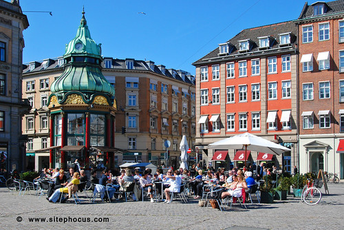
Living Urbanism is now accepting paper topics for our 2010 issue. Please send a 200 word or less description of your proposed paper topic to mike at streetplans.org or for consideration. The deadline for topic submission is Monday, February 15th.
All ideas are welcome.
If you don’t feel inspired to write, we will also be accepting select photos and illustration or images to include in this volume of Living Urbanism. Image submission requirements will be released in the coming weeks.
To get the 2009 Living Urbanism, please visit livingurbanism.org, or you may purchase a printed edition here.
The editors would like to thank all of our past contributors, and those who continue to support the continued growth of Living Urbanism.
Photo by Sitephocus
Filed under: Volume 002 | Tags: Living Urbanism, Living Urbanism Print Edition, Publication
 We are happy to announce that the latest volume of Living Urbanism is now available in print. Click here to order your copy today! A big thanks to all our contributors who made this volume possible. We hope you enjoy all that this glossy, 80 page, full color edition has to offer.
Has Public Space, Great Streets and Camillo Sitte ever been more relevant? Do you know what the ‘long tail’ means in the quest to crowdsource unique urban development? Ever wonder why Washington D.C’s seemingly pristine Metro just doesn’t deliver as much urban appeal as the New York City’s grimy subway? What is the true meaning of Phillip Johnson’s “Glass House?” Are you also looking for better ways to cultivate the collective mind power of today’s best urban planners? These questions and many more are mused upon in this volume of Living Urbanism.
Subscribe to our newsletter for details on how you can contribute to the next volume.
Filed under: Transit & Mobility, Volume 002 | Tags: Ian Rasmussen, Living Urbanism Print Edition, Metro, Subway, Transit, Volume 002

Image by Peter French
Introduction
The Metro, in Washington D.C., is by all appearances a model urban transportation system. Its trains run smoothly, quietly, and quickly. Its stations are well designed, with excellent signage, a cool breeze, and even lights at the edge of the platform that blink when a train arrives. The metro has further appeal in its regional scale, converting from central business district circulator, to commuter rail system as it travels further from the urban core.
By comparison the New York City subway is awful. Its trains jerk passengers about at starts and stops. Loud screeching echoes through stations as trains turn a curve or come to a stop. The stations are fluorescently lit and tiled, making their overall appearance like that of a public bathroom (a function which they have also been known to take). Worse yet, in is the summertime heat of the asphalt above seeps into the crowded stations. Also, unlike the Washington Metro, New York’s subway never takes on the speed, the comfort, or the role of a regional commuter rail system.
According to the three central factors that should influence travel decisions, time, cost and comfort, Washington should have New York beat hands down. Its trains are fast, its rides generally cheaper (you can’t go one stop on the New York subway for less than $2.25), and its trains much more comfortable. Why is it, then, that just about everyone in New York takes the subway, yet the Metro captures only a fraction of Washington’s commuters?
According to planners, it’s all about density; and New York’ got it in spades. There is much truth to this point, and the transportation-land use connection (which basically says that people use transit where dense nodes of development surround transit stations) is now a nearly universally accepted concept. But doesn’t the Washington Metro have a reputation for encouraging dense mixed use development around its stations (i.e. the Rosslyn-Ballston corridor)? And while New York is certainly dense, its policies don’t directly encourage Transit-Oriented Development (TOD).
According to friends in Washington who are otherwise not inclined to own a car, the problem is “the Metro doesn’t go anywhere.” It’s true that there are large parts of Washington that are not well served by the Metro. But certainly the same can be said for New York, where the subway does not come close to extending to the city line, and avoids certain areas all together. As for the central business district, which is where it really counts, both cities’ cores are well served.
There has to be something more to it; how is this contradiction explained? The answer came to me on a random day, running out for a meeting about a mile uptown. It was 9:45 am, the meeting was at 10, and I was very late. I left my building at 9:46, 30 seconds away from a subway stop. I descended a single flight of stairs, swiped my card, and just when I hit the platform a train was arriving. Three stops later I exited, up just one more flight, and arrived at my destination a few minutes after that. Arrival time: 9:53 – 8 minutes after I left my desk in a panic.
That’s the kind of transit experience that makes you sell your car, or never hail a cab again—the kind of trip that the most successful transit systems are based on— because they show you any other way of getting there is plainly inferior. Then it occurred to me that a trip like that isn’t possible on the Washington Metro. To be sure, I don’t think there is an 8 minute door-to-door trip in the history of that system, or many others. While the metro shines over longer distances, and attracts a great deal of commuters as a result of it, despite having well-placed stations in its CBD, it simply can’t do 8 minute trips.
The Transit Tipping Point
Transit ridership is good for itself. Of course ridership is good and necessary for a system to exist at all. But, it’s not just that people using transit is good for the system, but that a sweet spot can be achieved where ridership begets more ridership. I call this the “transit tipping point.” It is the combination of factors which result in a pattern of increased transit ridership.
The transit tipping point occurs when a system is so attractive by comparison to its alternatives that it gains widespread use and thereafter gains the momentum to improve itself. More people are riding, therefore more service is provided, therefore more stations attract diverse uses, and – in turn – more people are riding, and so on. The best transit systems in the world share in this great success, where everyone who lives anywhere near the train is taking it or buses run every few minutes and stations or stops are surrounded by dense, mixed-use centers. Moreover, if you think about the small handful of places in this country where living car-free is a realistic option, their transit systems enjoy this type of success, too.
Originally, my purpose in exploring this subject was only to identify the factors that explain why some transit systems have failed to meet expectations, and others continue to succeed despite a lackluster experience. Only later, in further discussions of what “living urbanism” means, did the true motivation occur to me. Those who are fortunate enough to choose whether to own, or drive a car, enjoy a profound freedom that is as enjoyable as the best of public spaces, living in diverse communities, or any one of the goals to which new urbanists have dedicated themselves. Too often, though, transit has fallen short on its potential to improve our quality of life because it never reaches its tipping point – instead sliding in the opposite direction, disappointing its advocates, and fueling criticism. The point of this essay is to identify some ways in which that trend may be reversed.
The Well Known Factors Behind Transit Success
There are several well known factors that consistently lead to successful transit. Thus, before moving on to the subtleties that define the best systems, it is worthwhile to go through them. To be sure, all successful transit systems need to have these essentials in place.
Density
The most critical component in successful transit systems is density. (Otherwise known as the “Transportation – Land Use connection”). It’s the great built in advantage of the world’s best systems, and has even been given a fashionable name: “transit-oriented development.” (Which many of us in older cities think is a fancy description for an obvious idea). But it is not the density alone that is so powerful, it is the effect of the density on the transportation economics equation.
Generally, people are willing to walk to and take transit within a pedestrian shed (5-minute walk) of where they reside. More detailed research indicates that (quite sensibly) the propensity to walk (and walk further) increases with the utility of the trip to be taken – i.e. you might walk 10 minutes to a commuter rail station, but only 5 minutes to a light-rail.
The problem with these figures, is that they are using a single metric to correlate the results of the complex equation that is occurring. What other transportation options are available? Is there parking at the station? How much faster is the train than driving? How much more expensive? Every one of these variables is placed in the melting pot of transportation decisions.
Density around stations should be a central goal in the planning of transit systems. To be sure, it is present in every successful one. But, do not believe that you can’t make transit something that people in detached single-family houses aren’t going to walk 15 minutes to. In wealthy suburbs, from Winnetka to White Plains, people leave BMW’s in the driveway every morning to walk 15 minutes to a train. The question is why?
The Difficulty of Driving
Planners have offered up density as their big answer to transit success – and I largely agree. But my choice for the number two spot, even more rarely implemented than density and TOD’s, is policies that make it more difficult (i.e. expensive) to drive.
Said plainly, people who take transit every day do so because it’s cheaper than driving (in the sense of time, comfort, and/or direct costs). It follows that to discourage driving, by making it more expensive, would correspond with encouraging transit use. Every time gas or tolls become more expensive, someone takes the bus. If the bus route is changed to take five minutes longer, someone will opt to drive. These are the margins of transportation economics, and they are where the slightest changes have effect.
It’s an especially important point in light of the number of transit systems that flounder in spite of massive subsidies. After all, they have new trains, new stations; why aren’t people riding? The answer is likely that no policies to discourage driving were adopted when transit was introduced.
Note, I am not referring to policies that attract people to transit, such as tax-free fares or advertising. I am talking about making driving more expensive directly: tolls, congestion pricing, parking taxes, gas taxes, etc. Without these policies, it is nearly impossible to turn the auto-oriented masses into transit riders. The car is simply too good a deal as is.
In case you doubt the positive impact expensive driving could have on transit, just take a look at the few thriving commuter rail systems left in this country. Generally, they serve affluent communities where everyone own cars and shun public transportation. But how else can we explain that people in these communities are not only walking to the train, but they are walking further than we would ever expect. What really got them out of their cars? Traffic. Tolls. Parking. Gas. It has everything to do with driving being unattractive.
The Opposite – Transit is Simply Too Expensive Most of the Time
Using transit may prove faster a lot of the time and therefore be considered less costly than driving. In general, however, driving is almost always less expensive – in dollars and cents.
There are two points to be made here: First, transit is far too expensive (by comparison to driving) most of the time.[1]. This has a great deal to do with making driving comparatively more expensive of course, as discussed in the earlier section.
The second problem related to the cost of transit is the related cost of auto ownership. Unlike transit, where most of the travel costs are paid on a per trip basis, the automobile has the great advantage of sticking you with the costs up front, and making it a better deal to drive your car later. Given the large investment that is buying a car, in addition to mandated insurance and necessary repairs, it is estimated that car ownership costs Americans about $8,000 a year. So, when the cost of driving is being compared to using transit; well, you’ve already paid for most of the drive, so you’d better get your money’s worth.
The point is that the deck is stacked in favor of cars, before even discussing things like highway spending and subsidies for auto-makers. At the most basic level driving is, at present, a much less costly way to get around. Unless that equation can be altered, transit will not succeed.
The Hidden Factors Behind Transit Success
Now on to the hidden factors which allow a system to achieve the transit tipping point.
On review you will find that the consistent theme in all of these factors is that they capture short, spur of the moment trips. This is because in the same way some transit systems are successful in replacing the drive to work, they need to replace taking the kids to school, running to the store, etc. This strategy is contrary to much of transportation planning, which aims to get people to commute long-haul distances using transit. Not to downplay the importance of the commuter trips, but they only make up a fraction of the total. And, more importantly, it is the shorter unplanned transit rides that are at the heart of the transit tipping point – which will eventually lead to increased transit use by everyone from commuters to tourists. Plus, if the challenge is convincing new riders to try transit, it’s a lot easier to convince someone to take the train or bus for a one time trip than to alter their entire live-work arrangement.
Time
Headways – how frequently transit runs – are an under-appreciated part of the transit experience. Imagine you arrive at a friend’s house to find they live right across from a train station. Trains run every 20 minutes, home run. Trains run twice a day, worthless. Granted those are the extremes; if you insert headways into the transportation economics equation, they have a serious effect. When you consider them in terms of the goal of hitting the transit tipping point, they make a world of difference.
Transit options tend to fall within one of two categories: systems where you look at a schedule, and systems where you don’t (i.e. subway, vs. commuter rail). My general rule is that if service runs less than once every 15 minutes, I check a schedule. . The critical difference between these two types of systems is the extent to which they can influence spur of the moment travel decisions – that is, those that are happening at the margins.
There is a minimal cost involved in checking a schedule, but it is something you must do before you leave. For instance, if you are scrambling to get to a meeting you need to have checked the schedule before declining a taxi in favor of the train. There are likely many such spur of the moment trips that might go to transit, but instead end up in the automobile. For this reason the transportation systems at the heart of a transit tipping point are more likely to be non-scheduled systems, for the simple reason that they capture spontaneous trips.
But, that’s not the end of the story. The problem in this case is that because users aren’t checking a schedule, the duration of their trip is inextricably linked to the average wait time for service. Said otherwise, if the train runs every 14 minutes you probably won’t check a schedule, and you will also probably wait 7 minutes for a train.
The effect of this average wait time cannot be overstated. It is a deal breaker for certain systems, and what makes others work. To compare, take the train running every 14 minutes versus that running every 4 minutes. The average wait times of the systems will be 7 and 2 minutes respectively. In the case of rides lasting 30 or 40 minutes (which the planners are typically keyed in on), it has a minimal impact. But in the case of shorter rides, it has a much greater proportional effect which makes them worth taking or not.
Furthermore, there is a psychological effect at play; it feels good to get going, even sometimes when it will take longer to get there. There is hardly anything as sweet as when the train arrives just when you get to the station, and almost nothing worse than just missing one. Shorter headways trend towards more transit use, on every level.
Access Time
You’ll almost never hear about how long it takes to get from the street to the platform when people are telling you how long a transit trip is going to take. But given the difference between systems, it’s very significant. For example, catching a bus at the curb takes (in theory) no time at all, while arriving at a central urban rail terminal, on the other hand, generally takes several minutes to descend to track level. (The disparity is also clear in the comparison offered in the introduction [between the NYC subway and DC Metro] where the difference in travel time to the street varies from 30 second to 4 minutes). Making matters worse, this secondary trip occurs at either end of a trip, doubling its effect.
Again, in the context of systems designed to attract longer trips (30, 40 minutes), it hardly matters. But in the case of shorter trips, such as those in the urban core where the system is intended to act as a circulator, the issue cripples the system – such as with the DC metro.
As in the prior discussion about headways, the pure economics of the situation greatly favor easily accessible transit. And the shorter the trip, the more magnified the effect. Here, though, psychology plays a role because time spent seemingly at your destination, but minutes from the street, can drive you mad. For example, if you know your train is leaving the station, but you can’t navigate your way to the platform in time, you are left with stinging disappointment. The opposite is true at your destination – just think of how you feel waiting to get off an airplane when you are about to miss your connecting flight.
Therefore, it is critical that transit systems incorporate into their design the ease with which users can reach the system from the street; or where different modes of transit come together, that transfers be made seamless by design.
The Flat Fare
One the of the unique features of the New York City Subway, to which a great deal of its early success is attributed, is its flat fare (which was originally ten cents). This feature, which remains in place to this day (now two dollars and twenty-five cents), puts the system in the minority. Most transit systems today charge a variable fare based upon how far you are traveling.
There is a sense of fairness in asking those traveling further to pay a higher fare, and in the case of long distance travel options like heavy rail or air travel, it’s a necessity. But in the case of transit, the flat fare holds a great deal of allure in its many benefits: 1) to simplify the experience of travel; 2) to use shorter trips within the central business district to subsidize longer trip to and from; 3) to favor less desirable places, in effect creating a progressive tax on travel.
While the flat fare may actually make shorter trips disproportionately expensive, it eliminates any confusion as to fares because it is always the same. The weighing of costs can be done instantly, rather than having to look up how much it costs for a ticket from A to B. Moreover it completely simplifies the system of purchasing and collecting fares. These benefits, though marginalized by the introduction of electronic metrocards and the like, are significant.
The greatest benefit of the flat fare system is that it uses the proceeds of shorter trips within the CBD to subsidize trips to and from it. For example, in New York thousands of tourists each year use the subway to go from Central Park to Times Square. They pay the same price, per ride, as people commuting to and from the outer neighborhoods.
Finally, a flat fare serves as a progressive tax on locating near the CBD. Under a typical fare system, where further means more expensive, the cost of living far from the city center is twofold; not only is the ticket more expensive, but it costs more in travel time. Given that places with higher transit accessibility are (at least in theory) more desirable places to live, those less fortunate frequently live at the final stop or beyond. Though the flat fare can’t make their commute any shorter, it can certainly level the playing field in direct cost. In fact, the history of New York’s subway proves that the flat fare served as a catalyst for transit oriented development at new further-out stops as the system developed. This is because just as one more exit on the freeway is the mental justification for the sprawling exurb, just one more stop on the subway (no additional cost) was the justification for continuous corridors of TOD.
Therefore, the flat fare is capable of simplifying transit, uses shorter trips to subsidize longer ones, and is essentially the opposite of the so-called “Lexus Lane.”
A Case Study in the Hidden Factors: Denver’s 16th Street Mall Buses
I struggled to find a case study appropriate for this essay because most systems thrive or fail based largely on the well-known factors — namely density. That is until the recent CNU Congress in Denver, where the free buses running along the 16th Street Mall were not only the talk of the event, but the primary mode of travel for most attendees. To be sure, judging by the seemingly universal ridership, and their omniscient presence downtown, the buses are nothing short of a success story. What is more, they possess all of the “hidden factors” to achieving the transit tipping point; which, judging by the effect on their City’s CBD they have achieved (and then some).
To dismiss the well-known factors quickly: Denver’s CBD is relatively dense, but it’s no Manhattan. Buildings along the 16th Street Mall are generally 5-10 stories in height. Though the skyline does have some taller buildings, there are many denser city centers in America. As for the relative costs of driving and transit, my informal observations were these: Driving looked to be exceedingly inexpensive in downtown Denver as there was little traffic, but parking costs were high. With respect to transit costs, the 16th Street buses are free – you can’t beat that.
The hidden factors area really where the 16th Street Mall buses shine, though. Not only does this systems possess these characteristics, but to the fullest extent.
Time – The buses run on a headway of somewhere between 90 and 120 seconds. This means that schedules are unnecessary, and the average wait time attached to any spur of the moment trip is negligible. More importantly, though, is the psychological sense that you never wait. Standing on 16th Street, the next bus is always in view. In fact, the buses run so frequently that you can’t even really feel as though you’ve missed one.
Access – Of course with a bus system, there is great advantage with respect to accessibility; it leaves you right at the curb. But the reality of this system is more telling. First, it is important to note that while many systems are very accessible, but far from the action (i.e. the Las Vegas Monorail), the 16th Street Mall is the central spine of activity in downtown Denver. Therefore, this transit system really does drop you “right there,” so to speak. This couldn’t have been more obvious than when I hopped off to get off the bus to buy a drink from a sidewalk vendor, and by the time I had paid him, just got back on the next bus.
Flat Fare – Ok, the 16th Street Mall are free. But there’s more to say. No ticket machines, ticket booths, stopping the bus so the driver can inspect tickets and collect fares. The fact that the buses are free leads to increased ridership not only because it’s cheap, but also because you just don’t have to think about it. It’s painfully obvious that they capture every spur of the moment trip.
Conclusion
While our pursuit of a transit-friendly future has been focused on broader well-known issues in transportation planning, whether or not you drive or take transit is fundamentally a basic decision. With this insight, it is possible to create circumstances where transit ridership is engendered, and will create more of the same – the transit tipping point. While the ongoing debate is focused on TOD and modern streetcars, don’t forget the devil is in the details. And most people don’t “prefer” anything other than getting there faster, cheaper and more comfortably. If you can make those goals a reality, ridership will follow.
[1] I recently compared the two options, and for a basic 30 mile trip, the difference was roughly 4:1 in driving’s favor; that’s two roundtrip commuter rail tickets at $29, versus a little less than two gallons of gas at about $5.
—–
Ian Rasmussen is an attorney living in Forest Hills Gardens, New York. His practice focuses on land use, zoning and the legalization of good urbanism.
Filed under: Volume 002 | Tags: Camillo Sitte, Civic Realm, Living Tradition, Living Urbanism, Living Urbanism Print Edition, Public Space, Volume 002

Urbanists need to regain control. The traffic engineer and landscape architect have had their way with the civic realm of our cities and towns for too long. The public spaces of any master plan are in fact the most valuable aspect of the design. Care should be given toward their creation and they should not be turned over entirely to any one specialized discipline.
The conception of a great civic realm, anchored by wonderfully, local public spaces, should be the principle goal of any urban design. Beauty will last the ages. If we are to truly build resilient settlements their public spaces must endure for generations. We do not have the luxury to waste on failed endeavors. The founding, or renewal, of a public space is critical to the success of any urban place. The square gives a neighborhood its identity. With success in mind, Urbanists must utilize all the characteristics of a successful public space —particularly the required management and diverse funding that allow for them to endure. As the New Urbanists increasingly look to retrofit suburbia, a similar eye must be put upon the many lost, miss-used or forgotten spaces that exist within our built environment. All land must not be underutilized. Perhaps our society does not yet understand the benefits that non-traditional American public spaces provide? In other parts of the world, a “shared space” is a cultural foundation. They are the streets and plazas that allow city life to exist. Traffic engineers had no hand in the creation of Rome’s piazze. We must learn from these cultures, and as American’s understanding of public space evolves we should not be timid about introducing these ancient forms into our plans. Today no one is looking after the whole of the civic realm. Our professional culture has specialized out of existence the generalist. And it is the generalist that understands what is required to grow a beautiful public space. As Urbanists, we understand the whole system. As Urbanists, we can conduct the symphony required to produce authentic beauty throughout our civic realm.
“Today nobody is concerned with city planning as an art — only as a technical problem. When, as a result, the artistic effect in no way lives up to our expectations, we are left bewildered and helpless; nevertheless, in dealing with the next project it is again treated wholly from the technical point of view, as if it were the layout of a railroad in which artistic questions are not involved.” (Sitte, p.223) In 1889, Camillo Sitte published “City Planning According to Artistic Principles.” One hundred and twenty years later little has changed in the practice of city building. The value of artistically created space has still not found a voice in the modern world. Why?
Shaping the public spaces of our settlements to support an enduring way of life is essential to both the economic development of a place and its overall resiliency. For decades, the artistic expression of our public spaces has not been the driving force behind the projects that shape our built environments’ identities. Beauty, comfort and the higher ideals of a place must be resurrected as the organizing force for city builders. We are still trapped by the statistics of the engineer and dull line of the drafting ruler when it comes to how we create our built environment. A Living Urbanism requires a sophisticated civic realm.
Anatomy of our Civic Realm
The civic realm can actively be identified as our publicly celebrated structures. However, our libraries, churches and governmental building are only a small, but visible, piece of our civic realm. A mature civic realm can be conceived of as the entire system of public spaces both contained by these civic buildings and connecting them. Contrary to other classification systems, I would like to propose that the civic realm is made up of only two categories of public space. In the most complex of conditions Shared Space and Landscaped Space, supported by quality public and private buildings, can provide the full range of conditions required for a meaningful civic realm to exist.
A Shared Space can be characterized as a piazza, piazzetta, plaza and, most importantly, streets and thoroughfares. I find these spaces fall under the guideline that urbanism enjoys complexity. These are “mixed-use” spaces in true form. Surprising is that within the best urbanism these spaces make no special consideration for the car. Properly programmed, multi-modal and effectively scaled the street is the most abundant of all shared public spaces. Yet we dilute the street down to a traffic tool in all American conditions. Why? When there are so many precedents for how a street can support all modes of transport equally. Few, if any, engineers will stamp drawings for the construction of a true piazza, piazzetta or plaza effectively removing these timeless forms from the urbanist’s palette. Our struggles for reducing the width of streets has taken too long. The ability to develop a true piazza needs to be possible. We must resurrect Shared Space as a possible modern urban form.
Landscape Spaces exist to connect urban dwellers to nature and to support the emotional experience of the pedestrian. Landscape Spaces create the contemplative places within a village, town or city. They are formed by having a strong connection with nature. The quay running along the river Siene in Paris, the great lawn in New York’s Central Park and the tree lined promenades of Villa Borghese in Rome are all stunning examples of how a Landscape Space gives emotion and soul to a city. Care must be given toward balancing the scale, orientation and natural features of our greens, squares, gardens and parks to ensure they offer the urban dweller relief in any form they wish to find.
Physical Characteristics of Public Space
Is a boulevard really a successful public space if it does not provide a pleasing escape for the pedestrian? Is a small plaza really a successful public space if it does not allow for the cafe to swell in the evening filling ever available square foot with patrons? As we contort the forms of our civic realm to support the modern demands placed upon them by public process and the science of traffic “engineering” (Jacobs, p. 72) we lose the characteristic that allow these spaces to be the foundation for a vibrant and living urbanism.
“The design standards imposed by the highway engineering profession, for instance, are particularly damaging to community as they ensure the dominance of the motor vehicle over the pedestrian, even within the neighborhood. If I may say so, your profession [architects] could be of great help with this challenge of converting the planning and engineering professions, as surely you have noticed that the well-proportioned neighborhoods of the Georgian and Victorian era hold their value far better than the monocultural housing estates of the past 50 years.” (HRH Prince of Wales, 2009)
As Urbanists, we must take up the Prince’s challenge. By giving modern meaning to the characteristics of a quality public space we can allow a boulevard to be a boulevard and plaza to be a plaza. We should no longer support the hybrid, or false, forms being forced upon our citizens.
Balancing the form of a public space is essential. It is most successful when all three dimensions of the space, as well as the surface treatments and sculpture, are considered in concert. It is understood that the containment of a public space is critical. Establishing the constraints of the outdoor room is also linked to the width and length of a public space. As mentioned earlier, we struggle to create narrow streets. I would also like to propose that our squares, and if we could build them, plazas and piazze are much too large.
“In former times all the arrangements and building forms we have enumerated were joined naturally in a unified arrangement that enclosed that plaza. In contrast to this, one tries in modern times to lay the plaza open. What this implies should be clear form what has been said above. It is equivalent to destroying the old plazas. Wherever such a disastrous undertaking has been carried out, the spatial effect is lost forever.” (Sitte, p. 176)
Christopher Alexander has also developed several patterns which I find often over-looked in contemporary practice.
“Pattern 61 – Make a public square much smaller then you would at first imagine; usually no more than 45 to 60 feet across, never more than 70 feet across. This applies only to its width in the short direction. In the long direction it can certainly be longer.” (Alexander, p. 313)
“Pattern 123 – For public squares, courts, pedestrian streets, any place where crowds are drawn together, estimate the mean number of people in the place at any given moment (P), and make the area of the place between 150P and 300P square feet.” (Alexander, p. 598)
Do modern planners or landscape architects consider the population of a public space when considering its most effective size? It is time to reexamine the size and proportions of the public spaces we design and ensure that they are appropriate to the activities, surrounding architecture and number of users. Size does matter.
Layers exist within all great public spaces. Picture the Piazza del Campo. The image of Siene’s Palazzo Pubblico, with its great tower, might come to mind, or the comfortable slope of its fan shaped form. But, with further scrutiny one can begin to see the layers of this space more clearly. The cafés, with their deep sienna brown awnings, situated on the ground floors of the surrounding buildings establish the outside layer and give the piazza its essential active edge. Just as important as engaging uses at the ground level is the composition, slightly varying fenestration and harmonious cornice line of the surrounding buildings. The tower pierces the perceived ceiling of the piazza completing the required characteristic that a public space be engaging in all dimensions. The tower can quickly be established as this spaces center, but with more investigation one will find that the square in fact has many centers. The portico of the Palazzo, opposite the portico is the Fonte Gaia, typically the square as several vendors dotted along its inner edge, the ring road between the cafés for strolling the circumference of the space and the sloping red brick floor with its many groups of seated onlookers all provide a difference experience. The addition of each of these layers enriches the composition giving the public space more significance.
Significance for public space can mean many things. Great spaces possess significant gravity. Several blocks away one should be able to sense, as if it is pulling you in, the nearing public space. This energy emitted from a significant public space attracts more than just pedestrians. At times this can create a gradient of taller builds, more intense ground floor users and increase in the number of intersections and streets. This gravity can also give a neighborhood its identity. “I live just off Washington Square Park” not only uses the significance of the square to orient location, but demonstrates how the gravity of the public space imposes identity on the surrounding blocks as well. The gravity created between the constellations of public spaces present throughout a civic realm give additional vibrancy to the traffic that flows throughout the city. This pulse of mobility gives life to not only the centers of activity but the various arms connecting them.
There are additional spaces that surround and lead into the primary place. They are the foyers for publics space during large events, the quieter plaza filled with cafés just outside the busy market square or the commercial nodes just outside the gates of the public garden providing refreshments to the scene. A healthy civic realm has a constellation of iconic public spaces. Each of these individual spaces possesses a constellation of supporting space. They might provide relief during extreme conditions or give space for services to support the active edge of the square. A single public space is better when it is part of a series of spaces. This fractal relationship gives vibrancy and depth to a living urbanism.
Public spaces are living. They breathe, sleep, require maintenance and enjoy company. As urbanism ages it continues to grow, change and adapt to the conditions of the time. This is true of the public spaces within that urbanism as well. Over designed and ridged alignment to uses significantly hinder the successful aging of a public space. These spaces must possess a certain amount of flexibility. This is even true within the span of one year. The best public space can support its citizens throughout the year. There is no “session.” The life of the city should not halt in winter. Prague does not close its squares due to cold weather. The many groups, clubs and organizations that a loved public space establishes will further extend the life of these places. These groups will give guidance to the space and provide resources as it ages. Quality public spaces are living infrastructure.
Beauty is Essential
A timeless public space is beautiful. This perhaps is the essential characteristic. Beauty is of course in the eye of the beholder. However, on average the dull, rigid and sterile places that mid-century planners conceived of as beautiful public space have failed. Beauty to the masses, not to a small group of intellectual designers, is essential for a public space to be successful. This beauty ensures the long term enjoyment of a space is certain. Fashion changes too frequently. To let it guide the creation of public space is a mistake. Beautiful squares, plazas, parks and gardens are multigenerational investments. Their form must be timeless for the required investment to be worth its value to a society. Beauty is more likely to be loved, and loved public spaces are more likely to spawn the groups required to maintain and care for it as the life of urbanism surrounding it unfolds. A loved public space endures.
Cycle of Involvement
What does the civic realm really mean to the city? Inevitably cultures and societies evolve. The civic realm provides the platform for this evolution. The civic realm is both the glue that holds a society together and a mirror that allows it to see its failures. This question is not correct; the civic realm means different things to different people. The meanings are not important, but the fact that the civic realm is present in one’s life is. We are just now becoming aware of what the lack of a civic realm can do to a culture and a society.
The civic realm engages the memory. It provides a physical history of a place either through the preservation of its best historic structures or through the generational interaction and story telling that gives rise to the myths of a place. The public spaces of living urbanism should persist within one’s memory. The mind should hold on to their image long since created. The most literal representation of the civic realms memory is those monuments and memorials erected to celebrate our past and the people who made life possible. Either in the squares of Savannah or under Napoleon’s Arc de Triomphe the physical memory is real. It is these memories, provide in large part through the civic realm, that serve to give a place its soul.
One comes to respect both one’s place and oneself more in the presence of the past’s greatest accomplishments. This respect, carried by the citizens’ sense of a place, resists filth, counteracts vandalism and elevates the spirit of said place. Given respect, by way of the connections to previous accomplishments, a successful civic realm’s public spaces will be cherished.
The cycle of a person’s involvement with the public spaces of their civic realm will come to teach them how to care. It will give them pride for their locale and its continued success. Pride will lead to ownership. The city will become one’s own and in time this ownership brings one further comfort in its spaces – a comfort that makes the city a home. Through a populations life cycle of experience within a civic realm, many stories will be crafted which, over time, will enrich the memories of a living urbanism.
Stewardship
A market square is more then just the physical space of the market square. Public space is a platform for the life of a city to unfold. However, a play needs its actors, script and time of performance to bring an audience. Successful public spaces require users. The best of these places provide activities for their users. The smallest parking court can be elevated to a public space when planted with a fruit tree. The cycle of caring for the tree, picking its fruit, smelling its flowers and enjoying its shade can create public space out of the simplest of utility areas. The activities in larger public spaces are produced. There are stewards of the space that initiate the production of the activities required to seed the cycle of involvement that leads to the long term enjoyment of a vibrant civic realm.
Just as important as the physical characteristics of a space are the activities carried out within, surrounding or through it. We have discussed the importance of the edge activities. But, often these need to be support and enticed by the activities available in the space proper. Just as the civic realm is divided into shared and landscaped space, activities can be passive and active. There is a strong correlation between landscaped spaces and passive activities. However, a quiet piazzette, with several café tables can be the loveliest of places to rest. Fred Kent, president of Project for Public Spaces, states that the best of public spaces are programmed by “zealous nuts.” It is these groups of nuts that knit together a square or park to improve its gravity, give opportunity for the creation of memories, and fundamentally provide for the enjoyment of future generations in the space.
At the center of a large publics space’s groups must be a “Friends of Great Kennedy Plaza” or a “Central Park Conservancy.” These organizations manage, fund and govern the ongoing operations of the space. They ensure its characteristics remain in place or improve. It is unfortunate, but modern urbanism requires successful large public spaces to be run like businesses.
Did Rome require Friends of the Forum? What kept the “geomorphic” spaces of unplanned cities running? (Kostof, p.43) We currently have no living tradition for the stewardship of our public space. During the last century, Americans learned that the stewardship of our native landscapes was worth the effort. During this century, we will learn that the stewardship of our village, town and city public spaces will be worth the effort as well. We must learn from Olmsted’s dual understanding for both the natural importance of Yellowstone’s preservation for the country and the complex details that would lead to Central Park’s success for New York. Both are of equal importance. Both required stewardship.
Local Economy
It is yet to be seen what type of global economy will be left, but being the optimist it is likely that global markets will still exist. The interesting thing about being competitive in a global market has a lot to do with the strength of your local market. For cities to be competitive globally they will need to differentiate themselves locally. Leveraging the advantages of the local arts, culture, landscape and vernacular building tradition is the foundation for cultivating a unique place in a global market. And we learned that a beautiful civic realm supports all of these items.
A resilient civic realm sets up so many factors that encourage innovation. In time of recession, people take to the streets with market stalls and push carts. These local economies would not be possible without established public space. Random encounters can lead to innovative interaction. The streets, square, plazas and parks are the places for locals to interact and improve their craft or practice.
What significant arts movement has been cultivated and supported by a suburban location? Movements, the type that inspire generations, begin in the cafés and piazze of our cities. The physical space of a city should be painted. Its beauty should be sketched, photographed and act as a well spring of creativity for future movements. A resilient civic realm captures the creativity of the group. The arts are perhaps the most radical of economies, but their practice is essential to pollinating the garden of innovation required for local economies to be successful. Fundamentally, a movement, either business or cultural, needs to be inspired. A living urbanism’s civic realm must provide this inspiration.
Civic and cultural institutions further enhance a local economy. Good public space gives visibility to these institutions and provides the essential link between the “Res publica” and “res privata”. These institutions are not only captured in the physical form of a museum or cathedral. Conservation can begin with a discussion in the square. Romance can ignite with a stroll through the garden. Just as a public space can give identity to a neighborhood, a resilient civic realm can help establish an attractive local culture. The institution of a romantic city can be a powerful enabler of the local economy.
Local economies are even more fine grain. The arrangement of public space gives identity to a district. The power of a good space provides the name to a neighborhood. These names can endure long past the time of their original conception. The economic power of a great civic realm can be demonstrated in the suburban shopping center habit of adorning placeless destinations with names traditionally assigned to the best public spaces.
A healthy social interaction, one that supports local economies, takes place in the public spaces of a living urbanism — commerce, or trade, originated in public space. That tradition is still present. I witnessed a chance encounter between two businessmen aboard a San Francisco trolley. One man hopped on, struck up a conversation with the man seated next to him and the next thing I knew they were getting off at the next stop heading toward the coffee shop to discuss a possible new venture. This is just one example of how a comfortable civic realm, not to mention public transit surrounding such areas, can support economic innovation. And if you believe Jane Jacobs, it is this type of innovation that keeps places alive.
Foundation for a Resilient Place
As Urbanists, we are responsible for helping to craft the foundations for a resilient place. A living urbanism is the best example of such a place. As we’ve discussed the creation, stewardship and enjoyment of a beautiful civic realm can have a profound effect on the successful passing of time. Celebrations and ceremonies are conducted within their enclosure, demonstrations are held in times of unease and direction given in times of crisis. The public spaces of our settlements are critical to their long term sustainability. These spaces are the constant throughout the lives of the citizens. Great care must be given to their creation and renewal. A beautiful public space can offer both a joyful reminder of the past and inspiring insight to the future.
As urbanists, we must realize that complexity is resilient. Natural ecosystems enjoy complexity as an essential piece of their endurance. Can a complex collections of public space help a local economy support itself during recession? Will these same public spaces improve themselves during booms? Many options are always more enjoyable than fewer and it seems as if contemporary planners, and even new Urbanists, are limiting the complexity possible in our built environment. A city or town should have a diverse selection of public spaces, each giving different types of citizens enjoyment. The stimulation of an elegantly complex civic realm keeps a culture renewed.
A living urbanism begins with community and space. It is the act of shaping this space that gives life to a place. Pleasing public space is the insurance that greater things are possible in a place. The quality of the civic realm is completely related to the comfortable level of density that the private spaces of a village, town or city can support.
A sophisticated civic realm allows for a compact population to exist. This population in turn improves the entire civic realm. It is essential for our projects to push this correlation. Achieving greater density is a significant piece of the puzzle that allows for transit, cultural institutions, local economies and an active street life to exist. It is this interdependence that makes the understanding and implementation of great public spaces so essential to our mission. As urbanists, we possess the skills necessary to lead the coming age of urban stewardship. It is time Urbanists regained control of our civic realm.
Works Cited
“The City Shaped: Urban Patterns and Meanings Through History”
“A Pattern Language: Towns, Buildings, Construction“
